Like, share and follow Charles Torello Photography on Facebook. Post #2.
In Post #1 I remarked on the trail in the middle of the photo – down towards the bottom of Grand Canyon. That’s the trail that leads to Plateau Point.
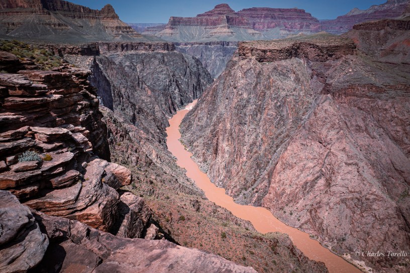
This photo is from Plateau Point. I’m facing west. I’m facing downriver. (In comment 1 you can see where this in relation to the full Grand Canyon.)
Plateau Point is where you can look down into the very bottom of Grand Canyon. You can’t always see the very bottom from the top.
That’s because Grand Canyon has an inner gorge. A gorge is, essentially, a canyon whose height is greater than its width. In this photo the river is about 1600’ below. You can imagine why the inner gorge’s walls often obscure views miles away at the top of Grand Canyon.
To those who don’t know, the river at the bottom of Grand Canyon is the Colorado River – whose source is at Rocky Mountain National Park in, yes, Colorado. I’m standing close to river-mile 89 of Grand Cayon’s 277 total river miles, all within Arizona.
(To those who don’t know, a “river-mile” is, essentially, the distance a river runs in its meandering course. As the crow flies from arbitrary point A to point B, the distance may only be 0.5 mile. However, the meandering river may run 1 or 1.5 miles from A to B. Thus, “river miles”.)
I’ve never rafted the river. That’s a bucket list item. I’d have to go with the right people too.
