
Much of the Red Rock Country has been flooded with tourists. The Devil’s Bridge, the Subway, Soldier’s Pass, Cathedral Rock, Fay Canyon, so on and so forth, are so filled with people that locals rarely go to these places.
So be it. If you’re gonna complain about tourists when you deliberately move to a touristy area, well, that’s like moving next to an airport and complaining about the airplane noise. What did you expect?
Besides, it’s easy to avoid crowds. Just go where they don’t go. And there are still gobs of places around Sedona where virtually no one goes, which I myself haven’t explored.
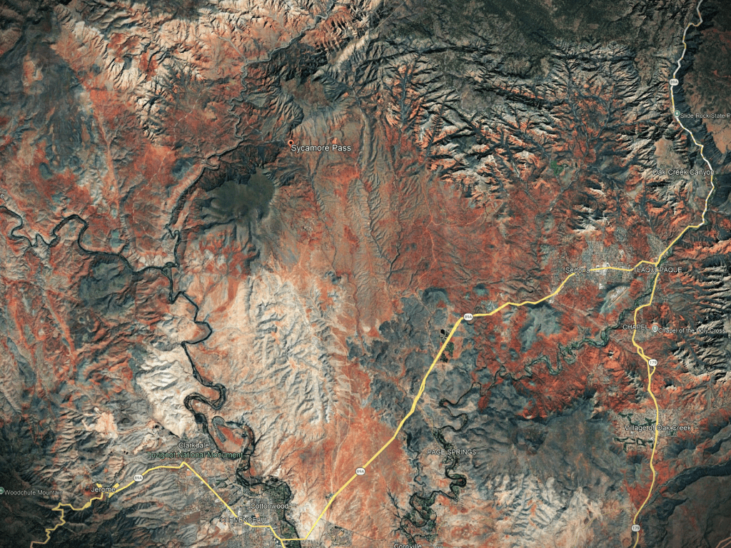
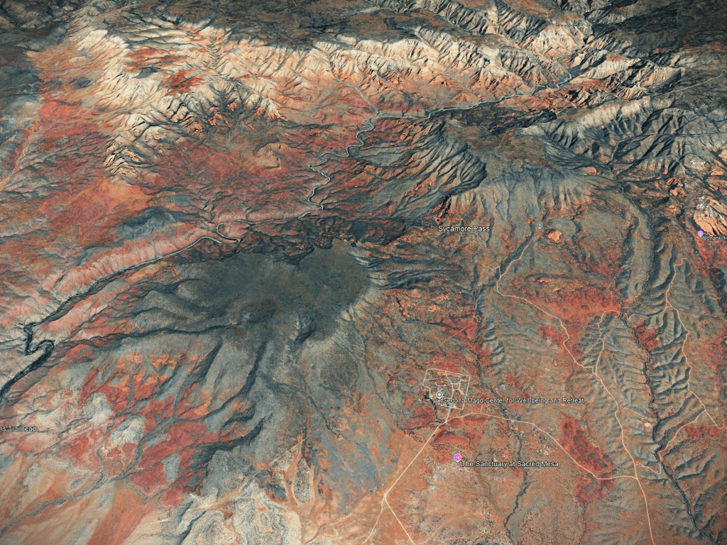
The area around Sycamore Pass is one of them.
Now, before I begin, let me just tell Gatekeepers to MIND YOUR OWN BUSINESS.
Gatekeepers are those who get angry at others who share relatively unknown places, especially on the internet, as I’m doing right now.
The “Gatekeeper Syndrome” is particularly virulent in Sedona. I can’t tell you how many people I’ve met who feel an exaggerated sense of self-importance for knowing places that others don’t. Their virtue really shines forth when they get angry at others for sharing places, again, as I’m doing now.
But I couldn’t care less for five reasons.
One, conflict with gatekeepers is fun. Two, very few people read this blog, and it’s not going to cause a flood of tourists to Sycamore Pass. Three, I enjoy sharing photos and words of the places I go. Four, if they bring amusement or wonder to a reader, that too is a good reason to share. Plus, five, if someone is inspired enough to go out on the land for a happy day, well, that’s even better.
(FYI, the dumbest thing I’ve heard from gatekeepers is that I’m promoting ecological disaster for encouraging people to go outside, as God intended. By sharing “secret” places, I’m an unethical, immoral, self-serving bad person – again, I love these reactions.)
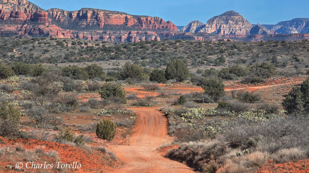
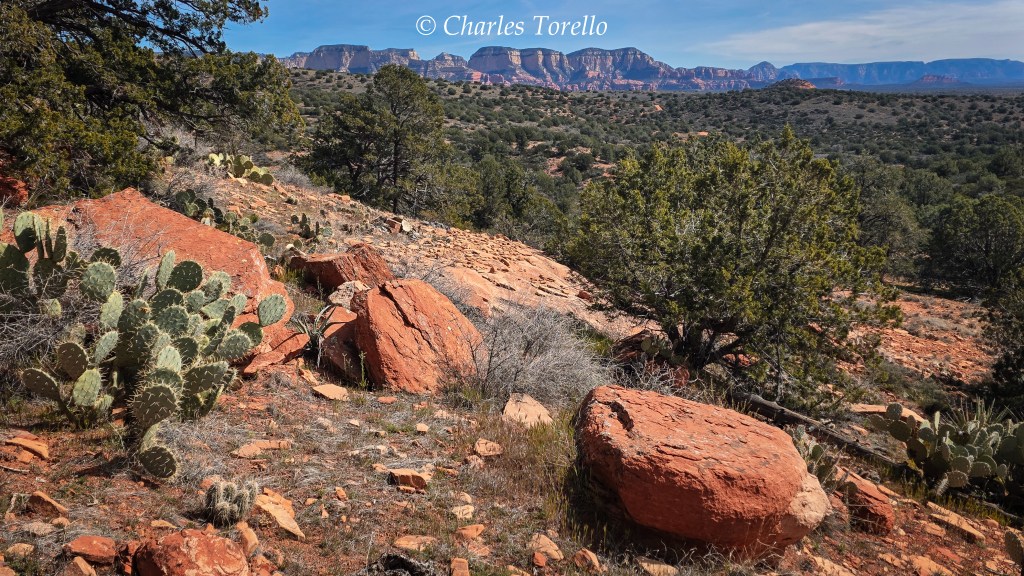
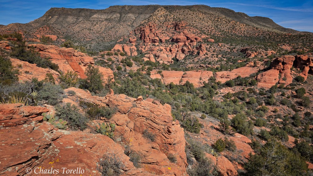
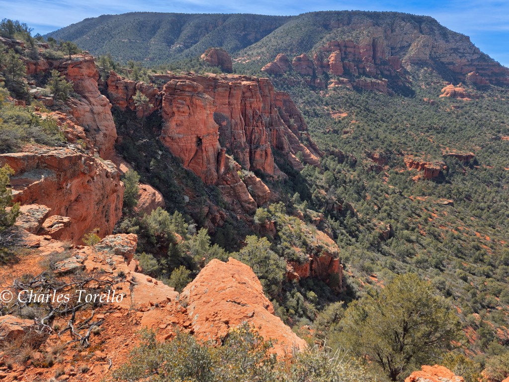
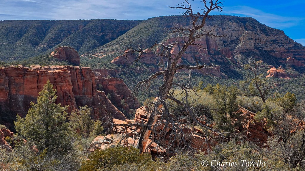
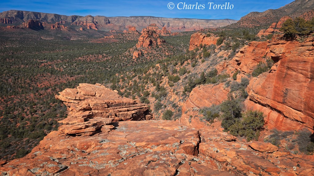
With the above said, the Sycamore Pass area refers to the ridge-divide between the Sycamore Creek basin and the Oak Creek basin (though Oak Creek itself is far from this divide, some of its tributary washes begin at this divide).
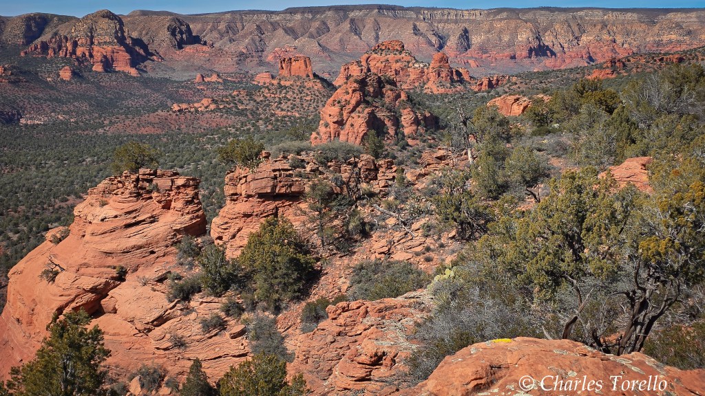
It’s what I call “Far Western Red Rock Country”. You get there by taking Forest Road 525 to 525C, and 525C to its dead end, right near the Sycamore Pass. I showed some locals this area yesterday.
Where 525C ends also begins a trail called the Dogie Trail, which seemed well named. I say that because an old song called “Cattle Call” randomly popped into my head while traipsing about the rocks, yucca and junipers. The song starts with the lyrics…
The cattle are prowlin’, the coyotes are howlin’; way out where the dogies bawl. Where spurs are a-jinglin’, a cowboy is singin’ this lonesome cattle call…
This 1955 song’s cheesy as hell. It’s not meant to be serious. It’s meant to bring a smile to people’s faces through pretty sounds and words that romanticize vast, lonesome landscapes out West, where cattle roam, or once did.
Anyway, a “dogie” is a calf abandoned by its mother. A dogie would be “way out” because the herd has left the helpless creature far out to pasture, and this lonely Red Rock country around Sycamore Pass feels like a place where a dogie or two was found when only cowboys knew these Red Rocks.
Hence, the Dogie Trail to Sycamore Pass seemed well named. I guess my subconscious mind knew something my conscious didn’t. Here the pretty landscape is as good an inspiration as any place out West for Eddy Arnold’s song, and that’s why it was playing in my mind.
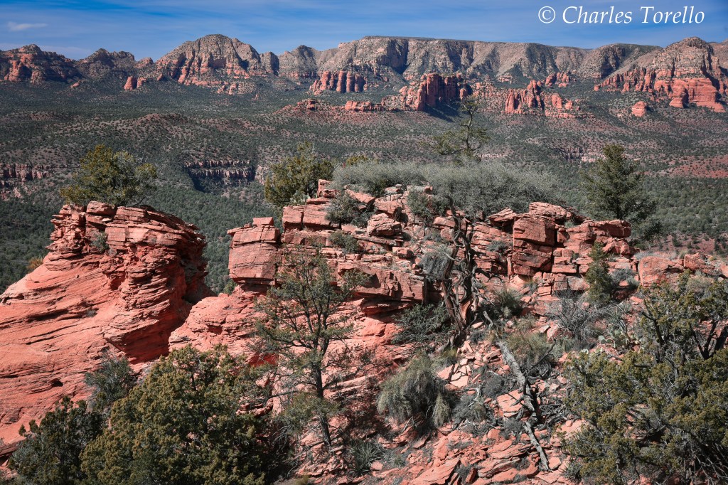
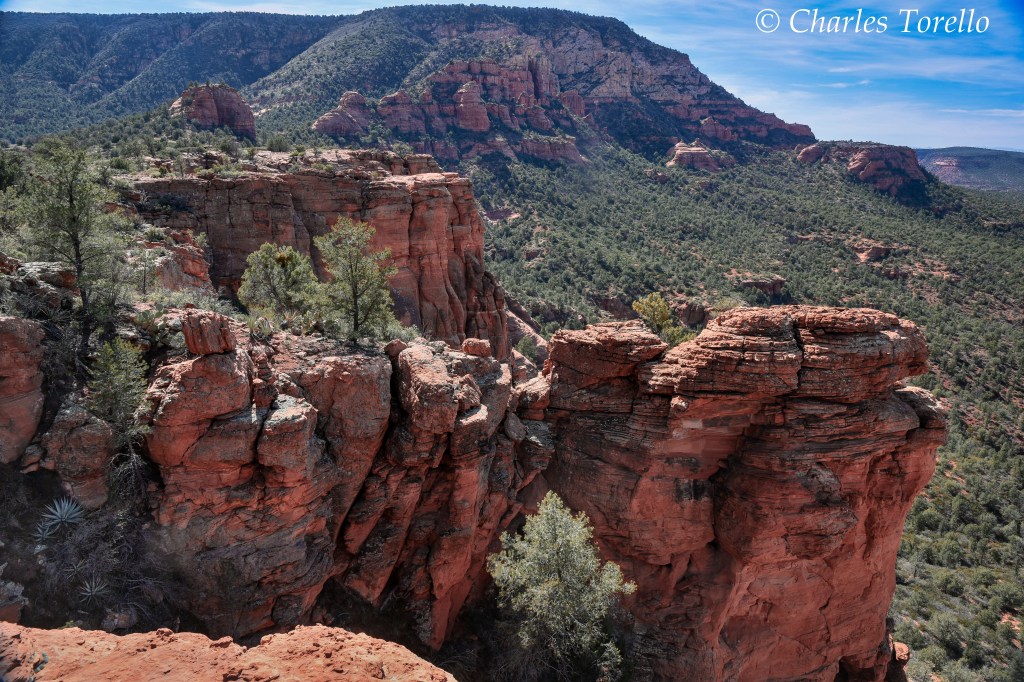
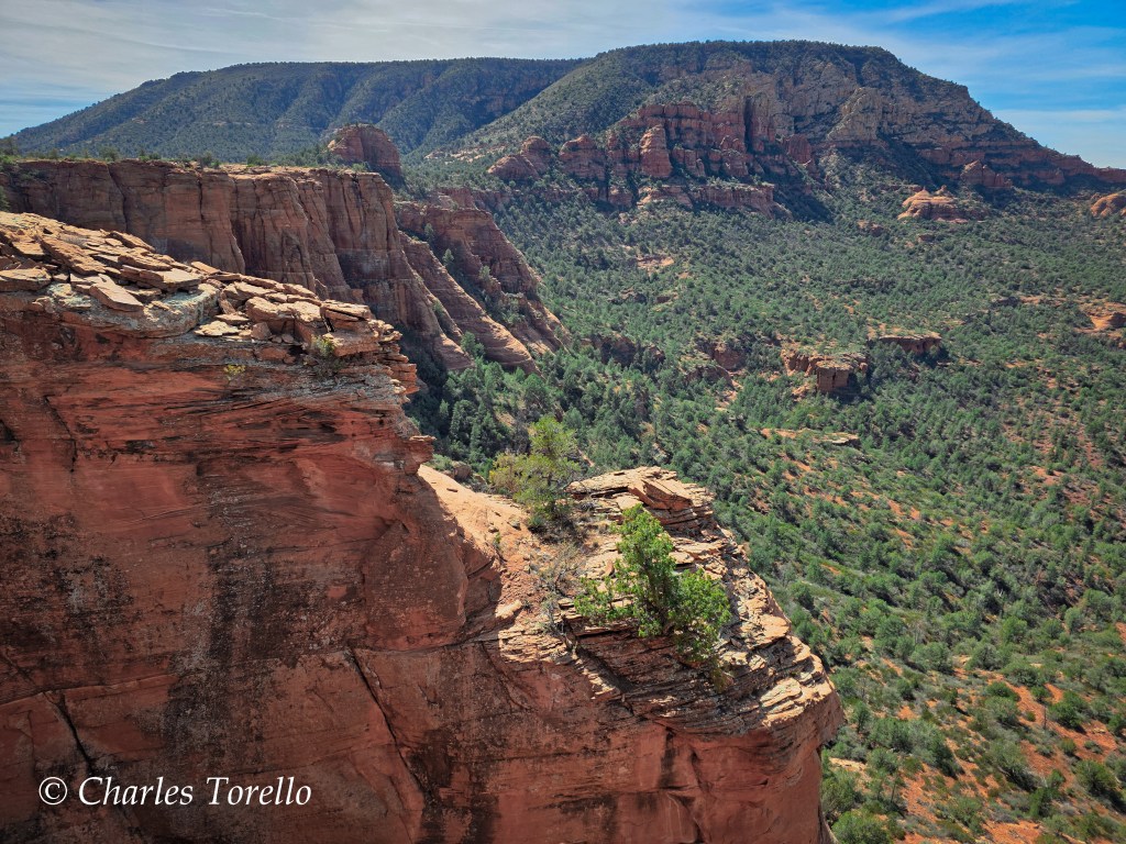
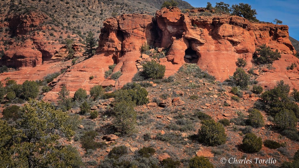
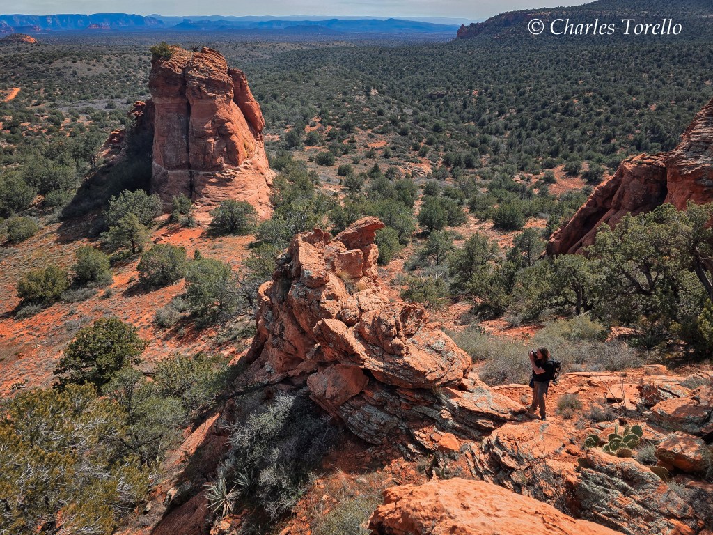
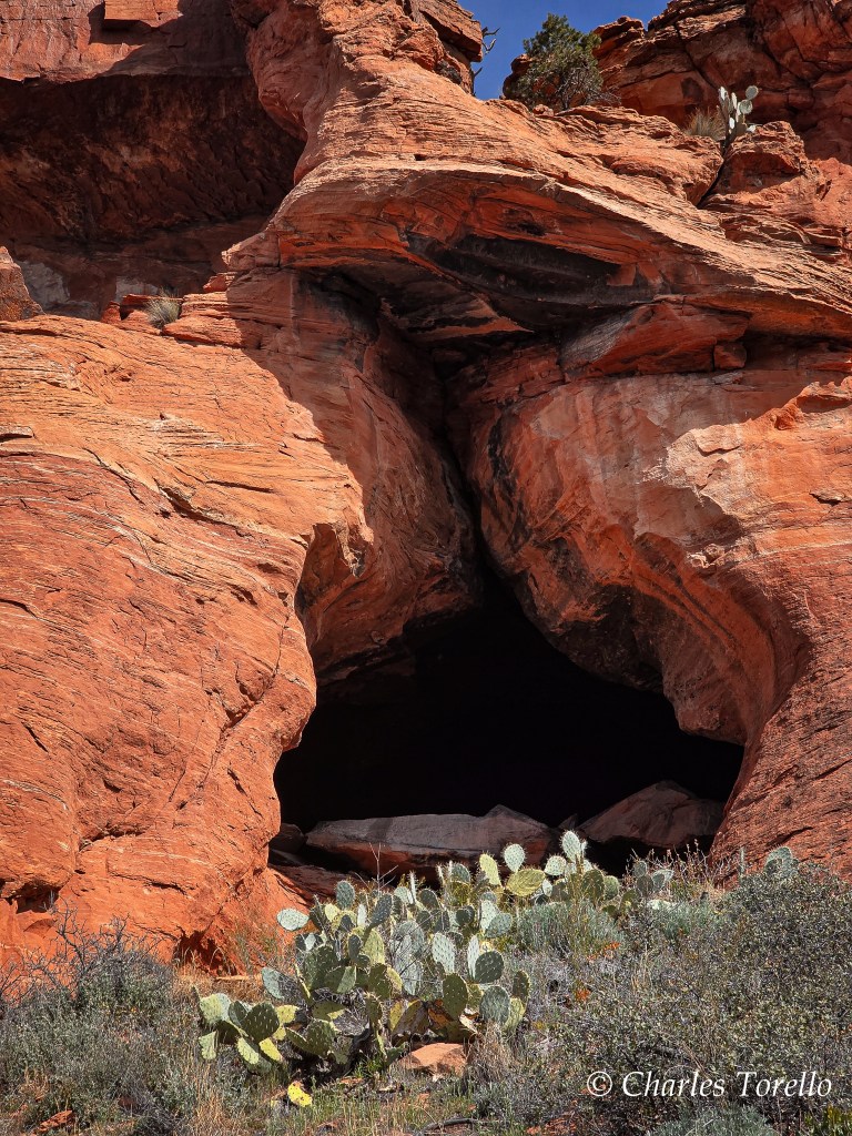
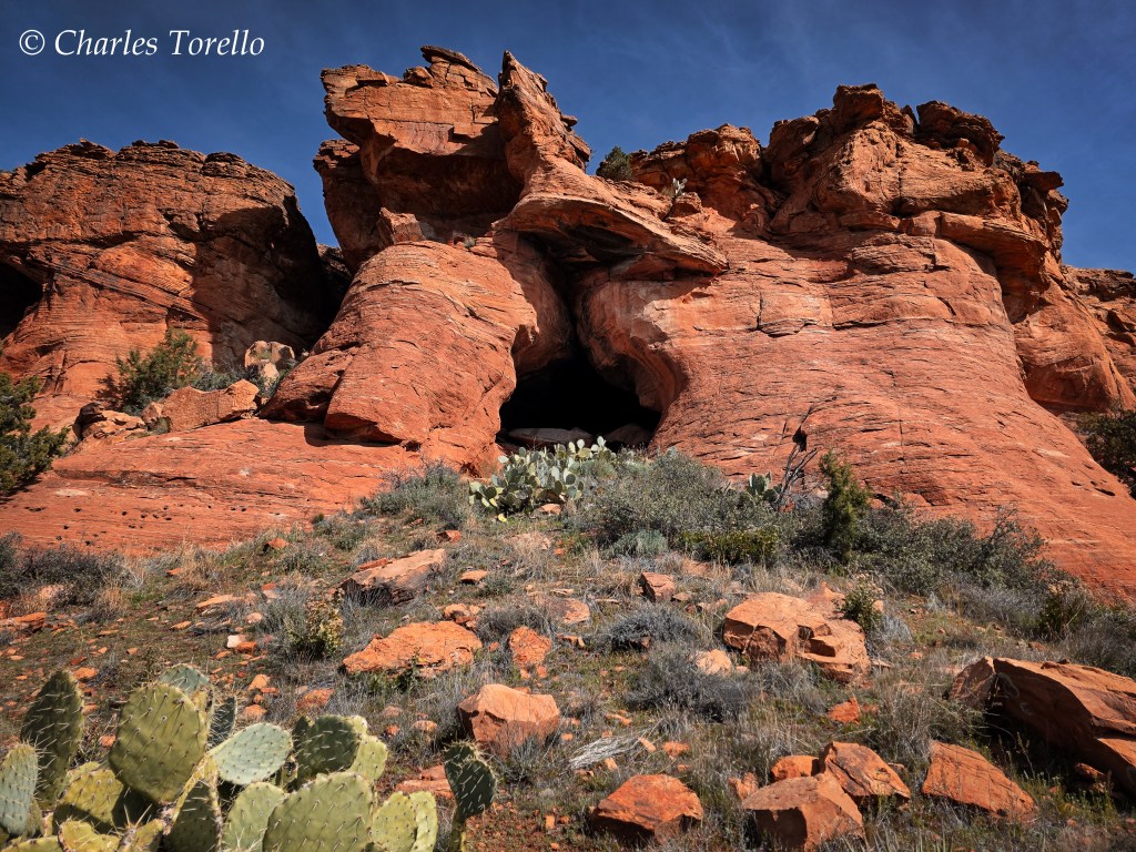
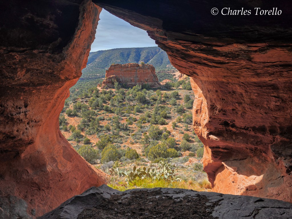
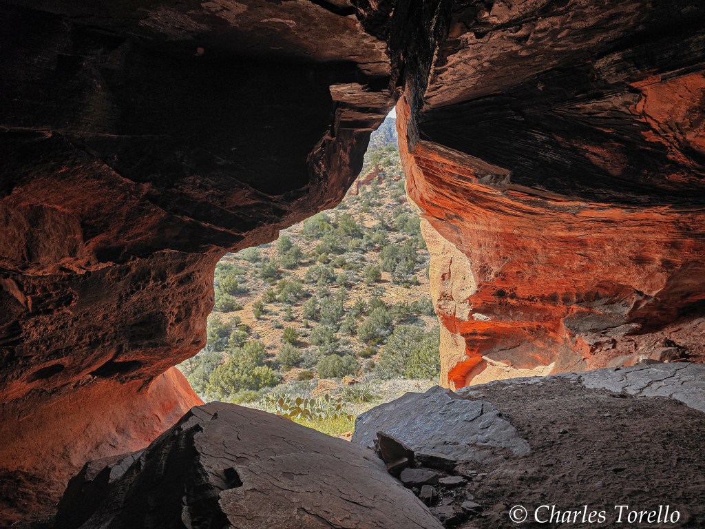
But we didn’t take the Dogie Trail. We followed an abandoned road and then took deer trails to a cave and then mesa top, where I spent an afternoon exploring and shooting.
The light was ok. Too many chemtrails. I used my Samsung mostly.
However, I can’t imagine the beauty to be seen here as the summer sky clears after a monsoon.

Hard to believe what must have happened so long ago to form this beautiful area. Amazing photography.
LikeLiked by 1 person
Well, Gary, my time in Arizona has compelled me to become a Creationist. I think the geology and topography of the earth is better explained through the dynamics of a catastrophe like the Noahic Flood.
Even if I were an atheist, I’d still believe in a Flood like you read about in Genesis, like you read about in countless versions across the whole earth from ancient times.
LikeLike