If you are inclined to scorn me for sharing what I will below, read my post Gatekeepers of the West.
ALSO, PHOTOS AT BOTTOM
Now, many people think a mountain range surrounds Sedona. Whether they are right depends on how you define a mountain, and I’m not going to say people are wrong because many of the Red Rock formations have the name mountain – Wilson Mountain, Munds Mountain, Bear Mountain, etc. I use “mountain” too.
But there’s a better way to understand them.
What really rises above Sedona is part of the southern edge of the Colorado Plateau called Mogollon Rim. The Colorado Plateau – and “Colorado” means “red-colored” in Spanish – is a geographical province characterized by red-hued sedimentary rock layers – mostly sandstone – covering approximately 150,000 square miles across the Southwest.
The Plateau covers Western Colorado, Northwestern New Mexico, Southern Utah and Northern Arizona. You can see a Google Earth screenshot of the Colorado Plateau below. See the red earth. That’s iron-oxide colorized sandstone.
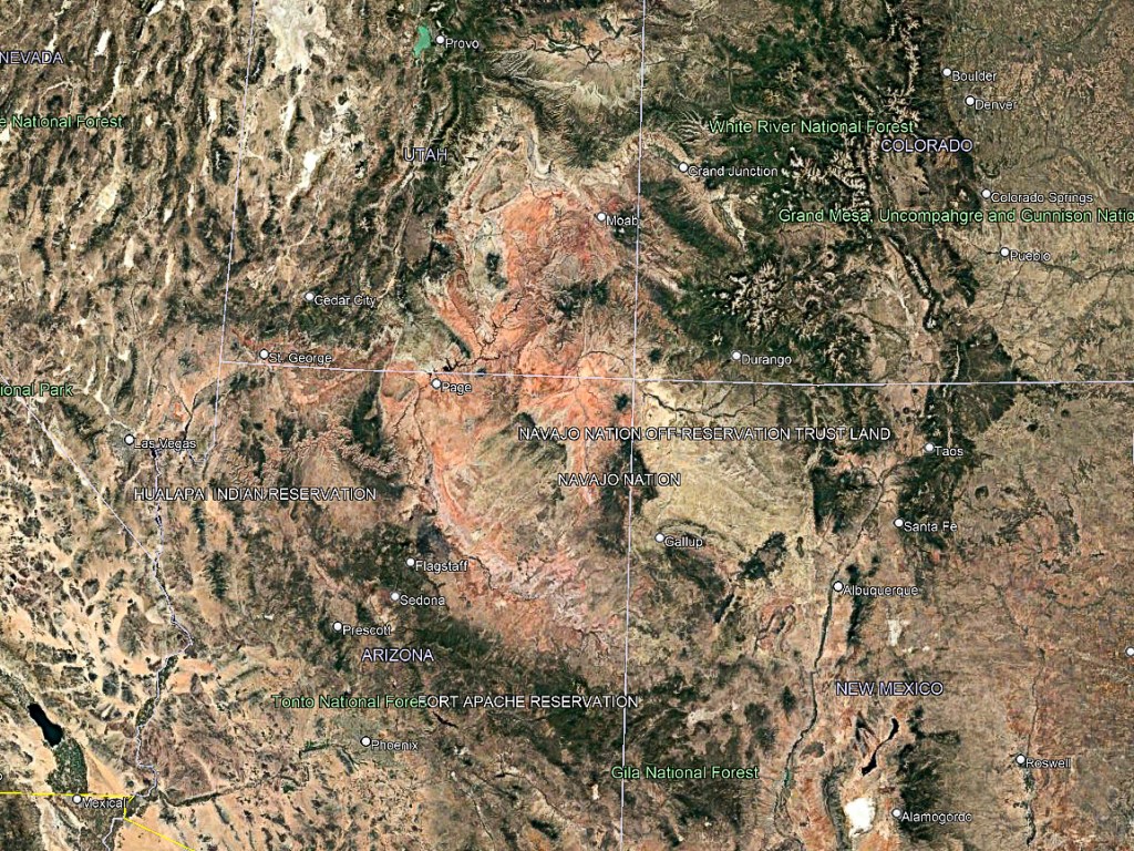
Now, the whole Plateau Province isn’t red-hued sandstone. Some of the sedimentary rock layers aren’t red at the surface. Black and gray volcanic rock called basalt covers much of the surface too. There are other factors, but none of them are critical to understand now.
What is important is the southern edge of the Colorado Plateau stretches for almost 300 miles across Northern Arizona, and can be very discernable, especially around Sedona, which sits at the base of the southern edge of the Plateau.
The reason that southern edge can be so discernable is that it takes the form of cliffs rising 2000′ to 2500′ above Sedona. That southern edge can be very discernable in other parts of Arizona, because of the sheer-vertical nature of those cliffs.
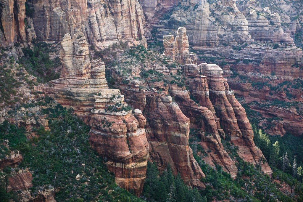
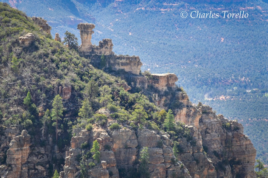
That edge is, again, called the Mogollon Rim, and “Mogollon” is pronounced “muggy-own” because gringos can’t pronounce the Spanish way of “moe-go-yone”. Rock formations in Sedona called mountains are just disconnected parts of the top of the Mogollon Rim, disconnected through erosion, and have the same, flat elevation as the Rim itself. Though, to tourists, the whole area can look like a mountain range, and that’s fine.
Now, because Sedona is at the base of the Colorado Plateau (or at the base of the Mogollon Rim) it’s technically not part of the Plateau. It’s in a transition zone from the “Colorado Plateau Province” to the “Basin and Range Province”.
However, it’s Red Rocks are as ethereal as any other Plateau landscape – landscapes like Grand Canyon NP, Antelope Canyon, Monument Valley, Zion NP, Bryce Canyon NP, Arches NP, etc.
Below is a snippet from Google Earth of the Sedona area, but not the entire area.
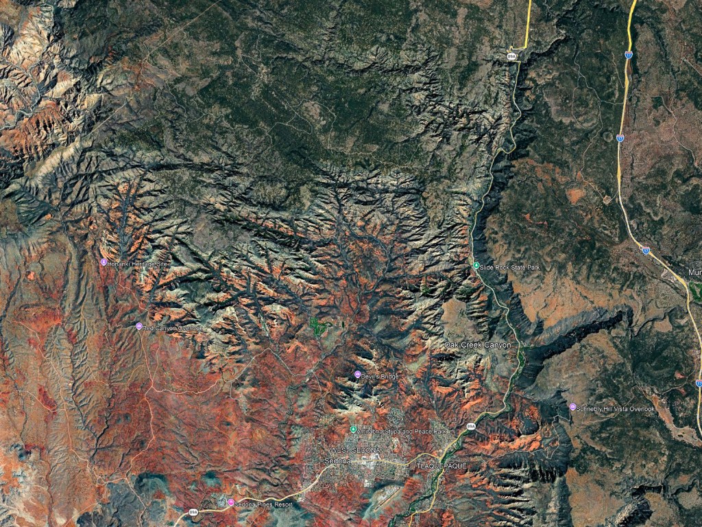
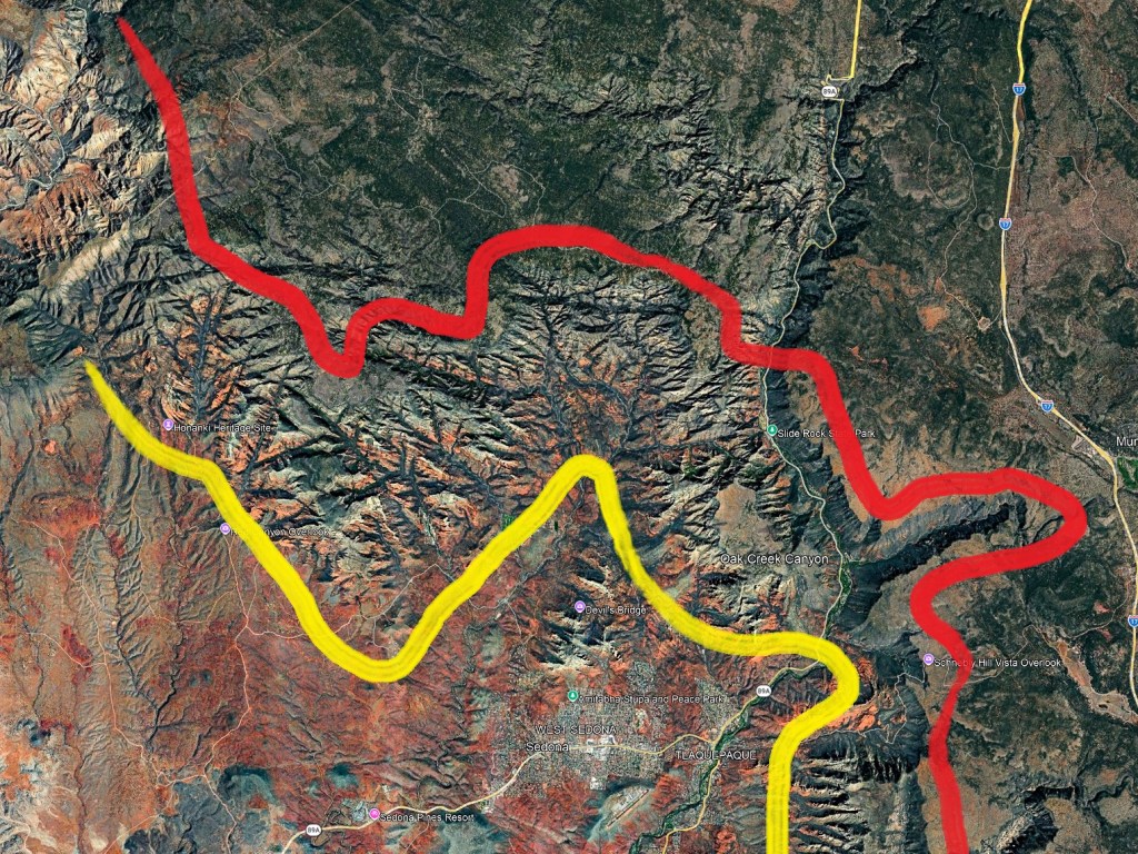
And below I have painted a yellow line and a red line on the above image. The yellow indicates the base of the Mogollon Rim. The red indicates the top of the Mogollon Rim. The exact path of both lines is a little arbitrary, as all geography can be arbitrary in transition zones. But you now have a general idea.
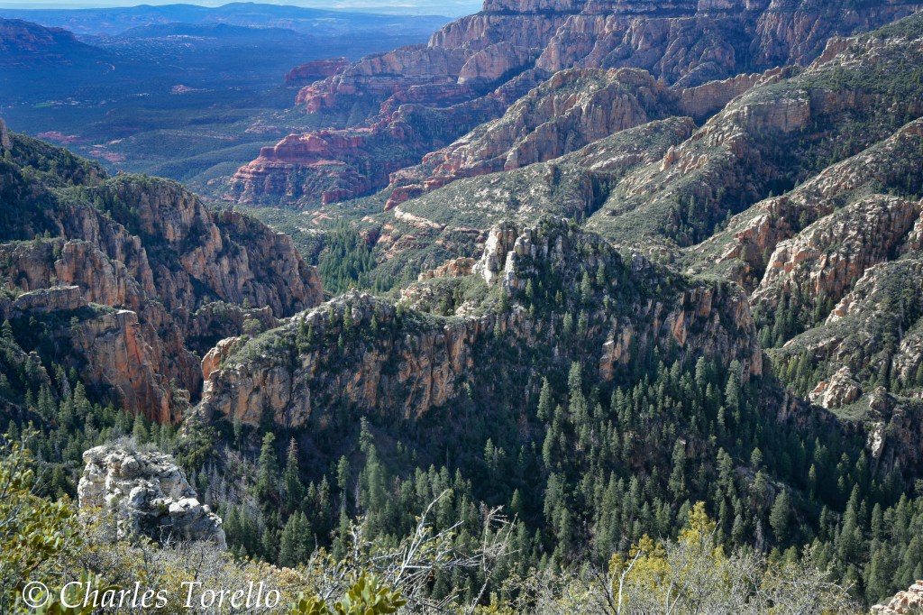
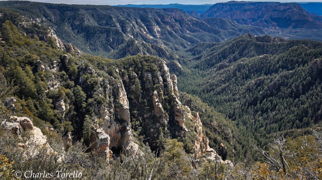
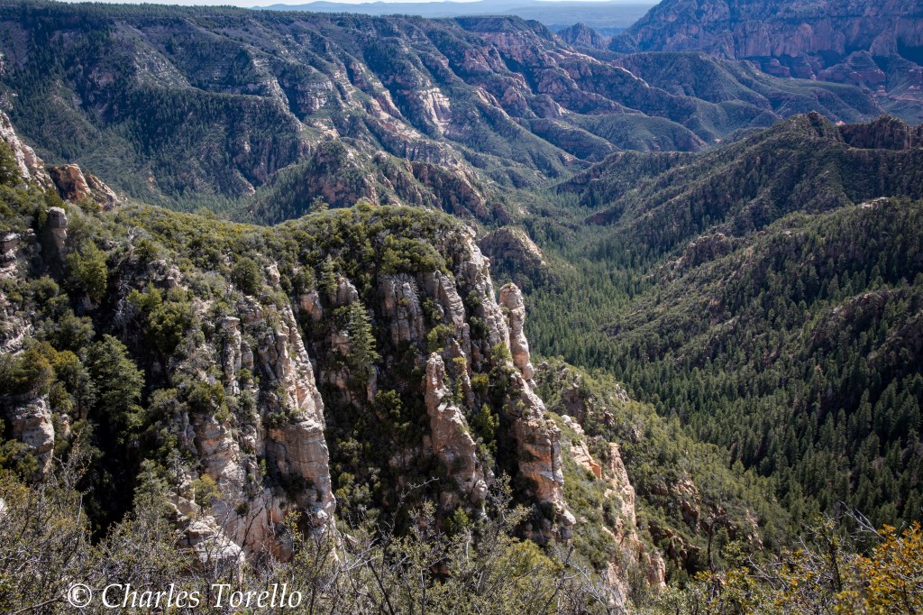
So let’s get to the point of this post. The really good secret are the views from the red line. They can be incredible.
As I said in A Secret of the West, America’s National Forests are America’s best kept secret. The views you can find in them are stunning. They rival the national parks.
I imagine many would agree that the Coconino National Forest may be the very best one to visit because of the Red Rock District in the Sedona area. “Sedona” is not a National Park. Sedona is a municipal corporation chartered under Arizona law, and the Red Rock landscapes surrounding the municipality are within that District of the Coconino.
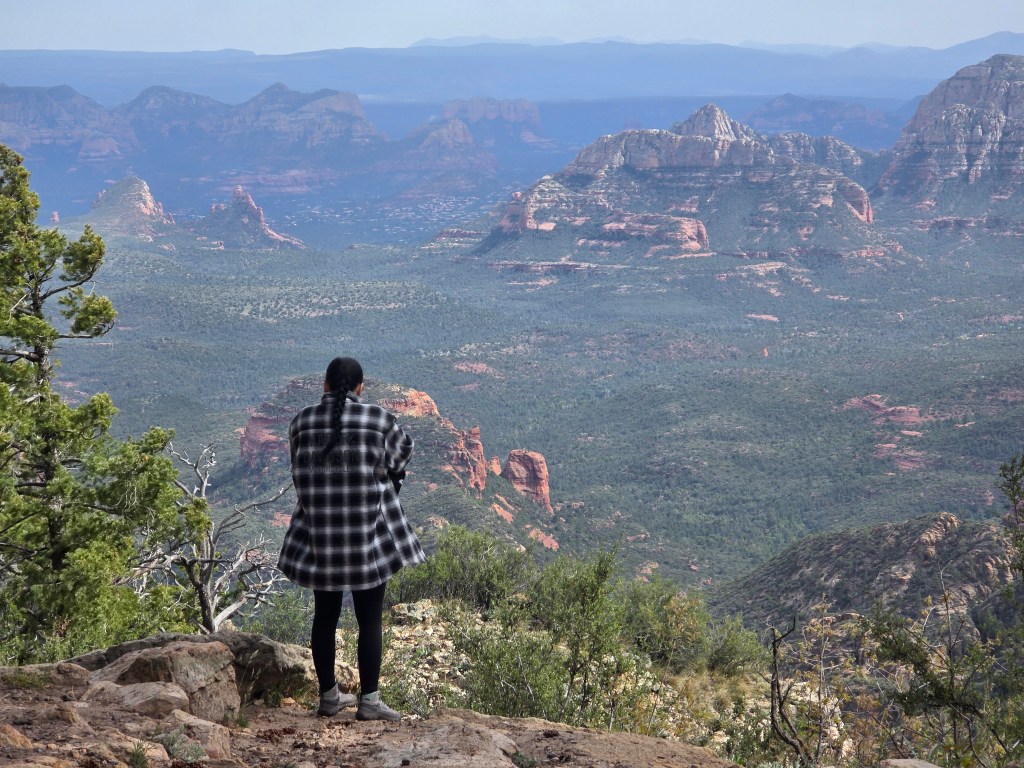
Most tourists are around the yellow line. They’re at the base of the Plateau. They’re in Sedona, and, indeed, the views are stunning, but, they aren’t a secret. The Red Rock District is heavily visited.
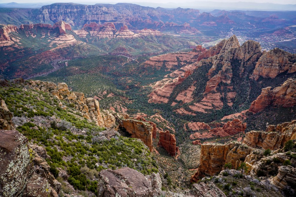
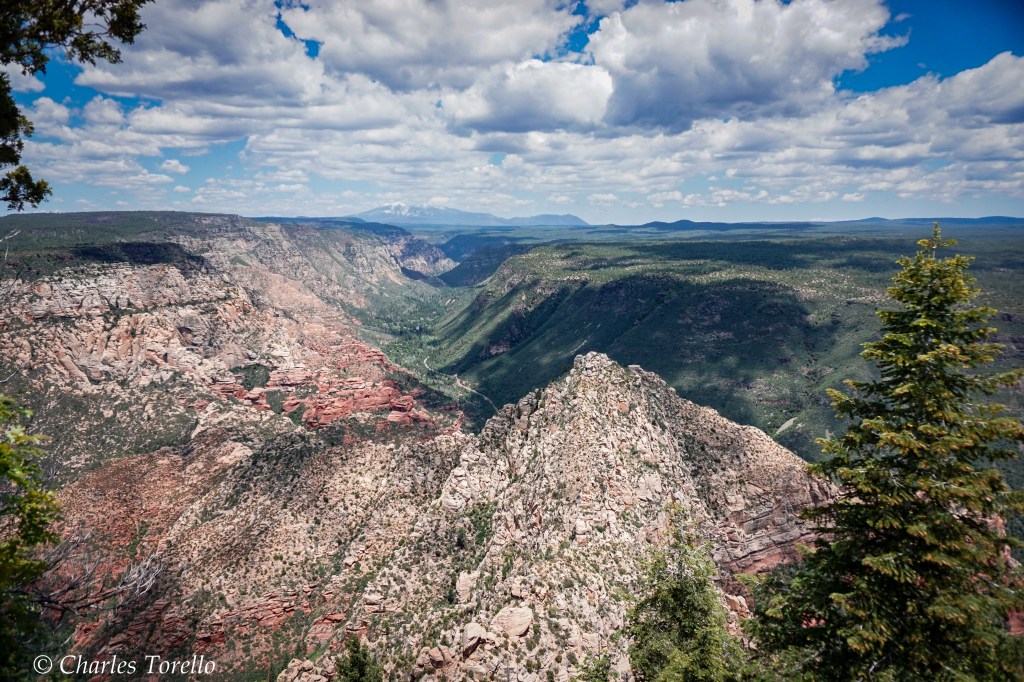
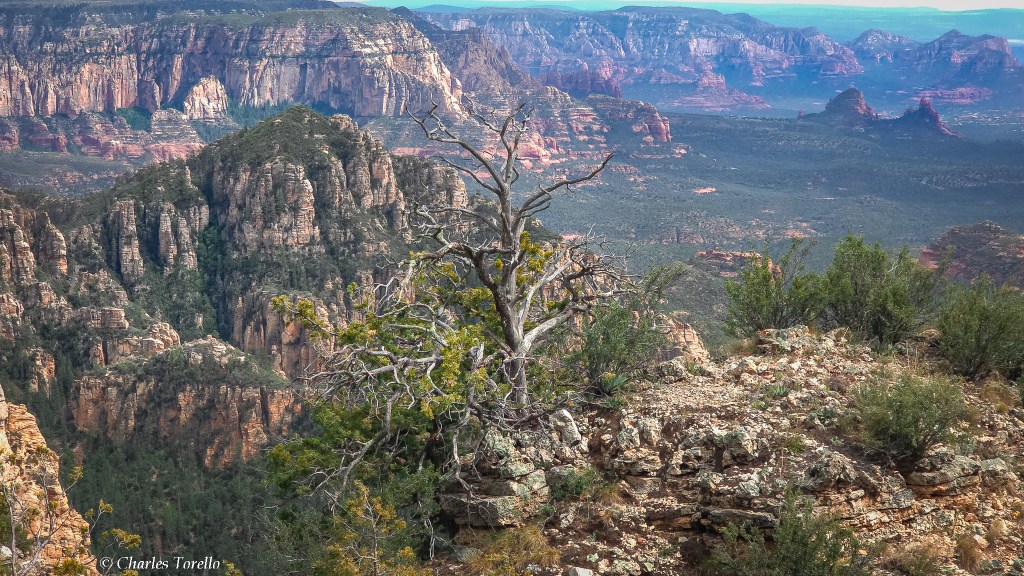
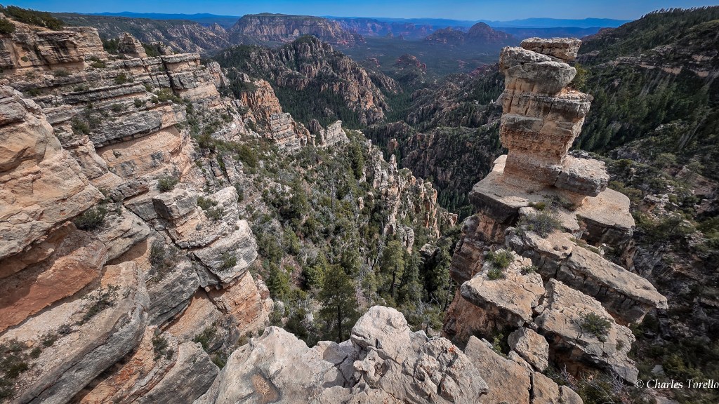
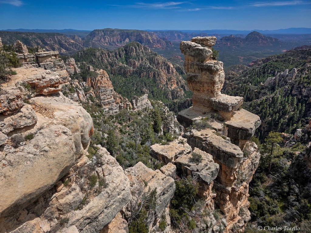
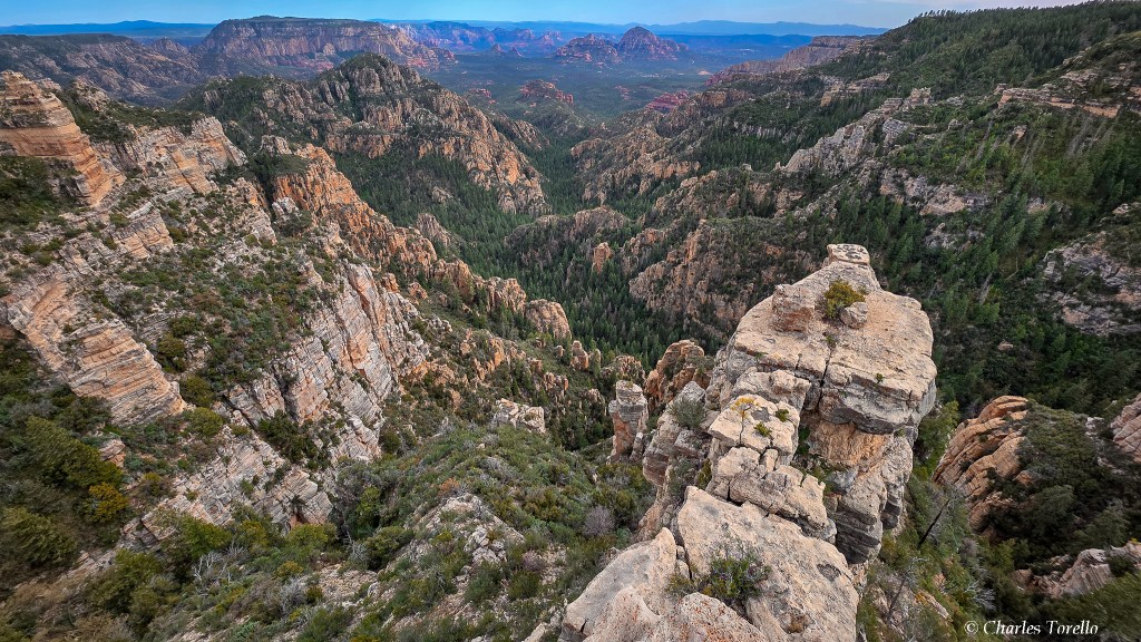
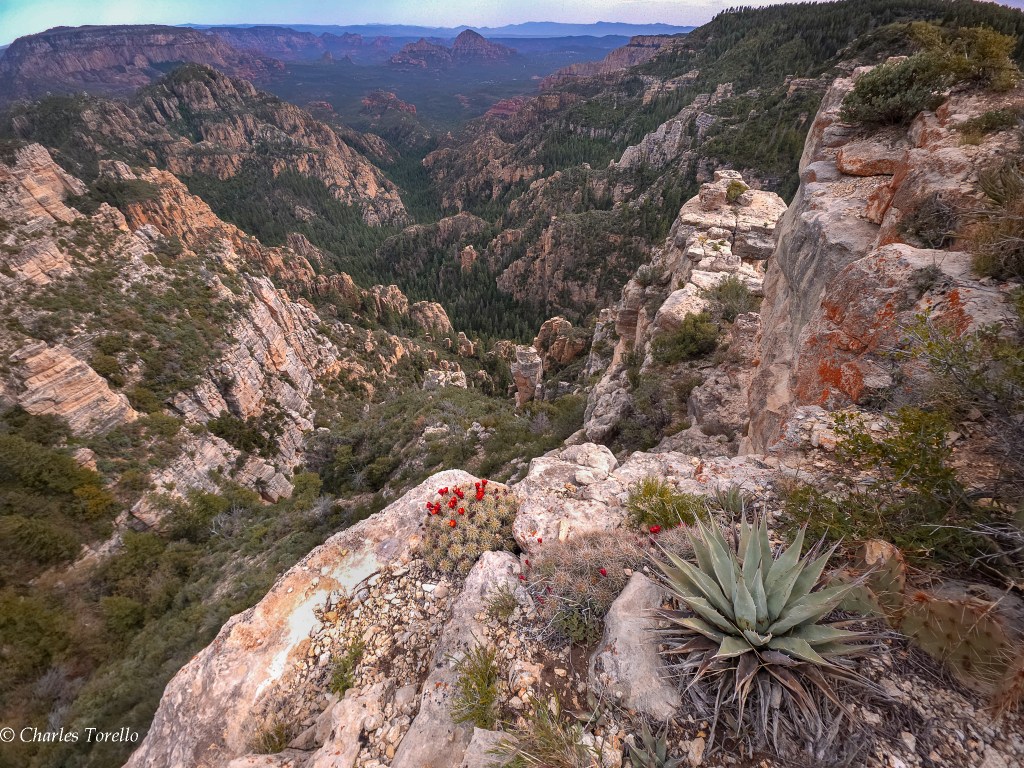
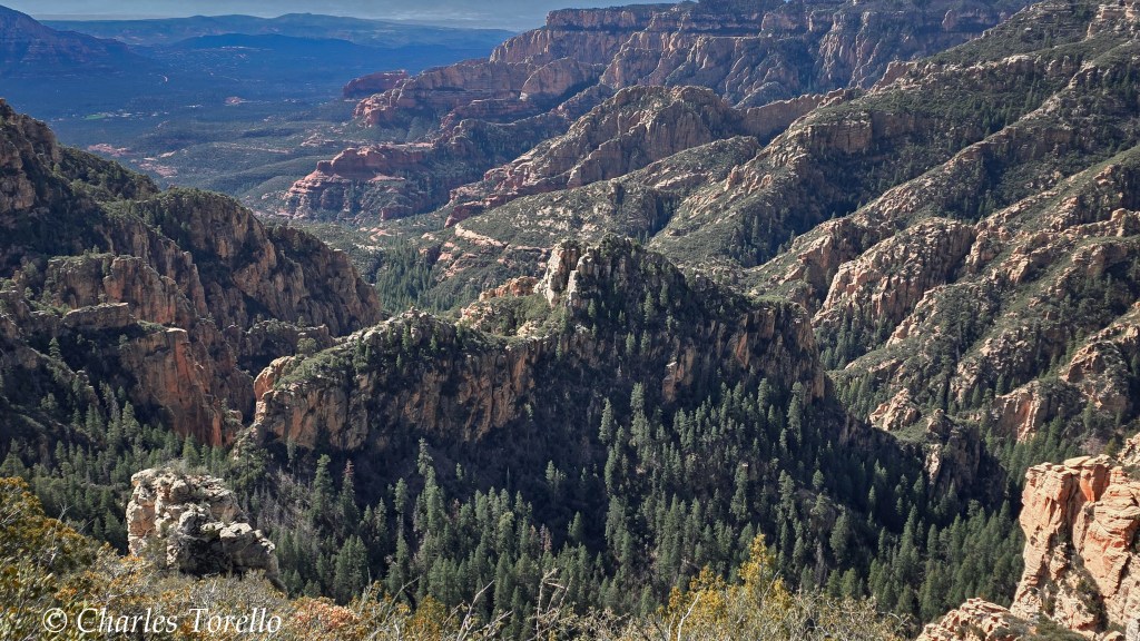
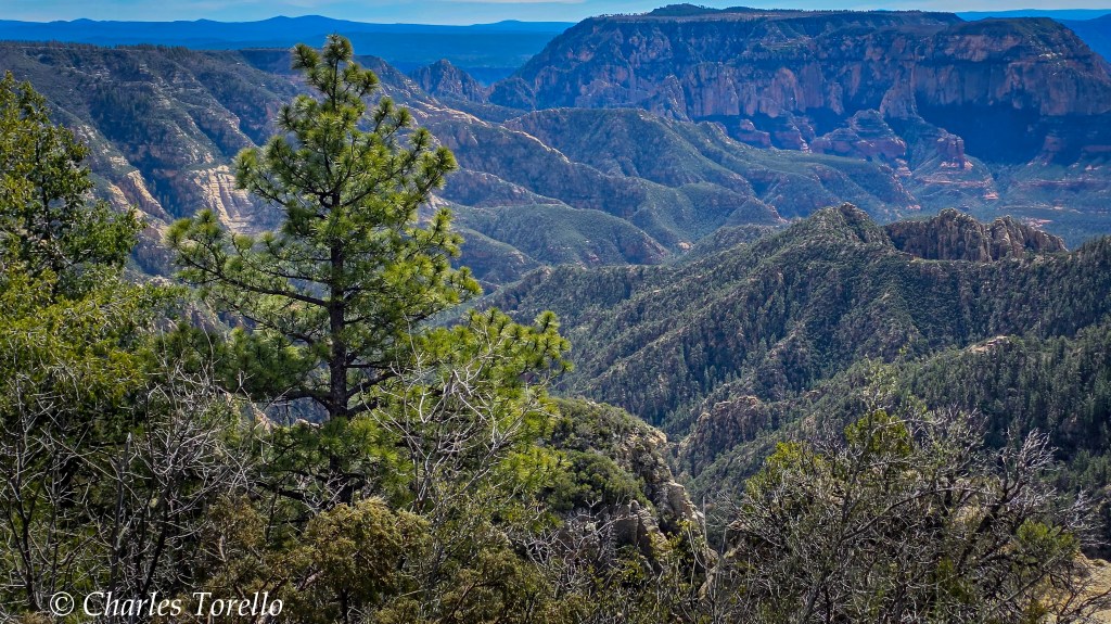
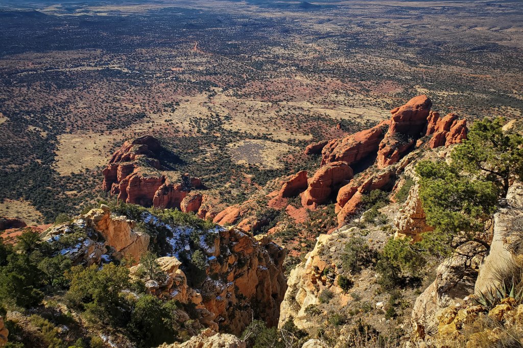
However, the red line denotes the boundary between the Red Rock and Flagstaff districts, and the views along the red line ARE a really good secret. They’re miles down unpaved USFS roads. You should have a high-clearance vehicle, and you need to be able to read paper maps to get there, unless you have Starlink .
They’re stunning because you are at the top of a giant plateau – called the Colorado Plateau – and you are 2000′ to 2500′ above the Red Rocks of Sedona, and the light and colors from up high are almost as good as Grand Canyon. If this area were a National Park, it would be in my Top 10.
I went there recently. Got some of the below photos. Others are older. I consider them OK, but that’s not the point.
In An idea for a journey into California mountains, I said how fun it would be to search out all the 75 secluded Sequoia groves over a couple weeks while truck-camping in the mountains. That would so cool.
Well, what if I were to truck-camp on the Rim overlooking Sedona for a couple of weeks? What if I were to do this during a stormy summer – let the rain fall, Almighty God! – and take epic photos?
I’m not trying to be dramatic. But, I don’t know why this idea hasn’t occurred to me before. I’ve been to this part of the Rim before. I’ve seen Sedona below me, and have been blown away before.
But that doesn’t matter. It would be a cool idea, and it is a blessing in life to have something so inspirational to you a not-too-far distance away from you.
Unless God has other plans, I plan to spend more than a few days up on the Rim above Sedona this year.
However, there is another part of this Rim country that is perhaps even more mind-blowing, and through the photos I’ll share in the next post, you’ll understand.
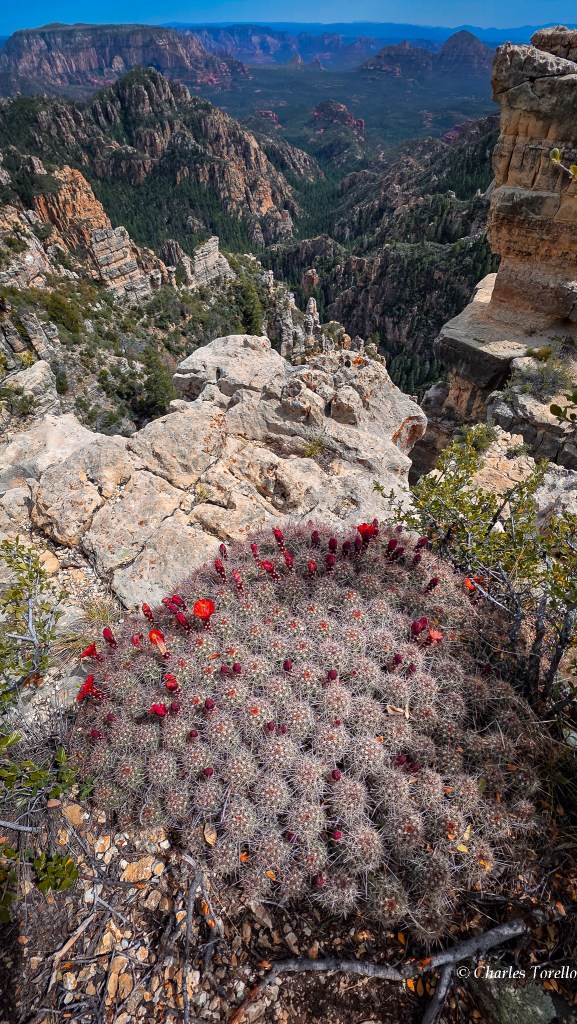
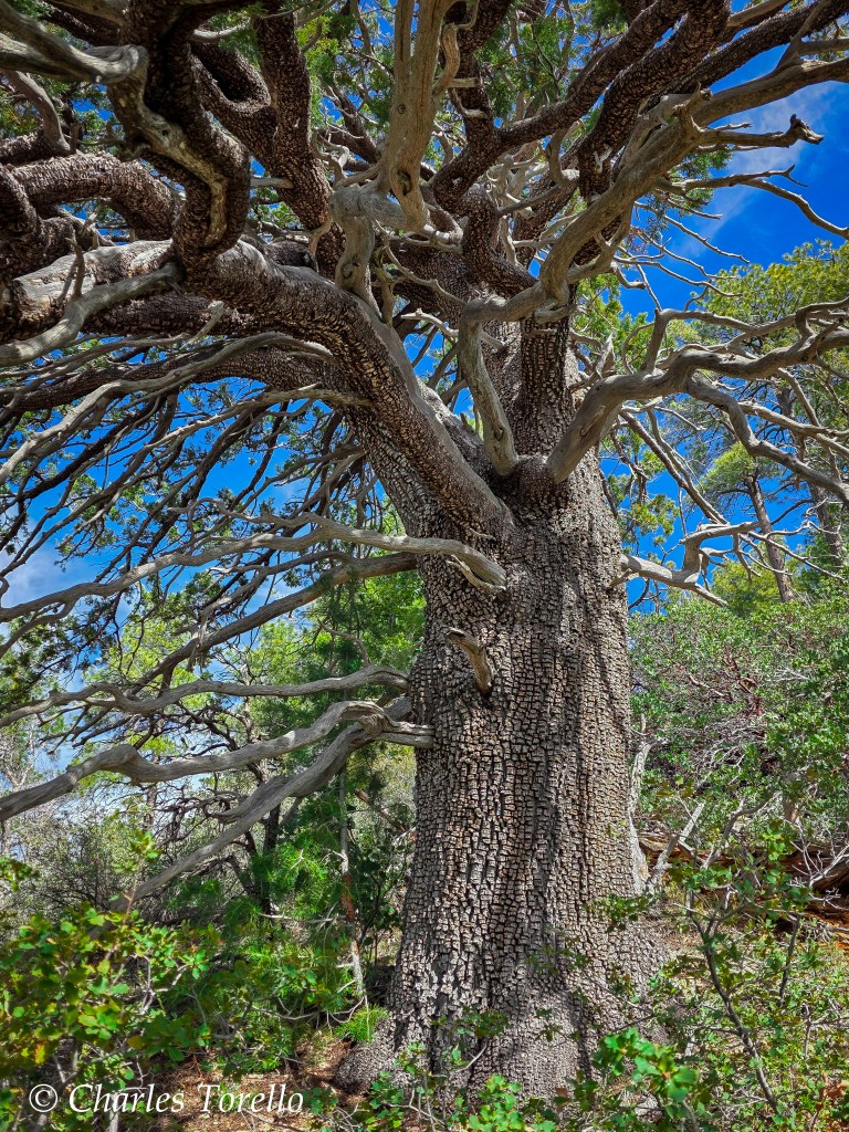
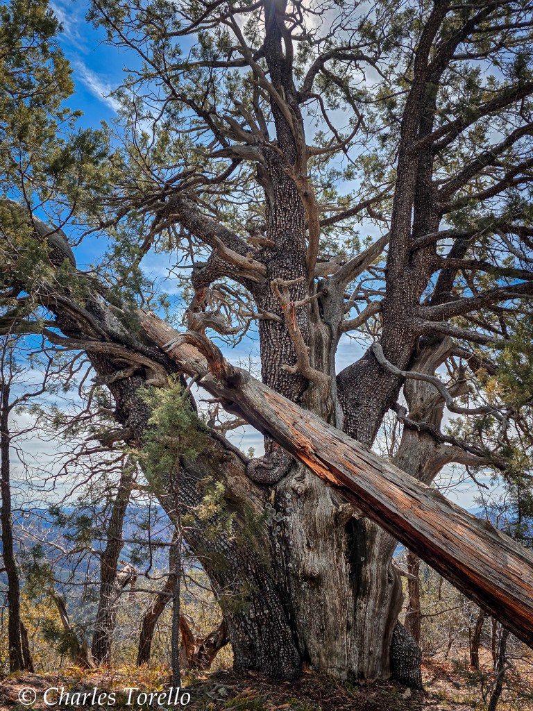
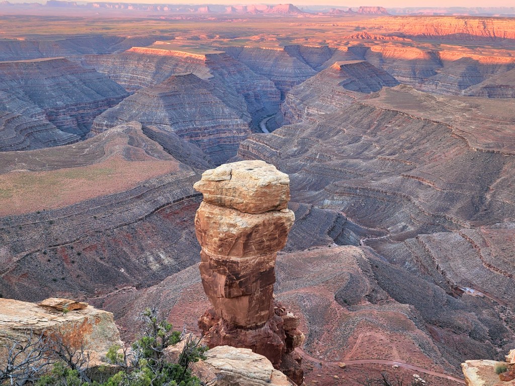
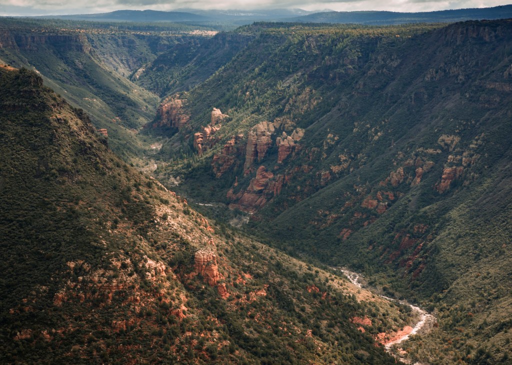
The below are a bunch of photos over the years of the Mogollon Rim over Sedona. Again, I can’t believe I don’t have more.