Lone Pine sits at the eastern base of the Sierra Nevadas. Its elevation is 3727′. It sits close to the base of Mt. Whitney, which is the tallest peak in the Lower 48 at 14,495′. Whitney thus rises 10,768′ over this lone California town on US 395.
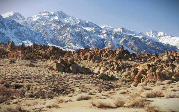
Between Lone Pine and Mt. Whitney are the Alabama Hills. They’re, essentially, clumps of drab orange and brown igneous rocks that form hills and arches with the snow-capped Sierras making quite the impressive backdrop. That’s why the Alabama Hills – named so by Confederate sympathizers after the warship CSS Alabama – served as the setting for many Hollywood movies, from B Westerns in the 1920’s to 1990’s “Tremors” to Star Trek 5 and 7.
Lone Pine’s also just north of Owens Lake, which, once upon a time, was the lake into which the Owens River once flowed. But no more. Los Angeles bought up the water rights to the Owens River a long time ago. Los Angeles killed the orchards and farms that Eastern Sierra snowmelt once gave life to. The land returned to dust. Now, Lone Pine depends entirely on tourism, like so many places in the west.
It’s pretty out here – though California’s got prettier places for sure. My motivation was sheer curiosity. It was to enjoy the buzz of a drive.
I’d been out to Lone Pine before, in May of 2017. However, since then, I’ve read too much Los Angeles history. And, since I was close by at Death Valley, I thought I’d let real images fill in the blanks of my imagination for a history I’ve told many times.
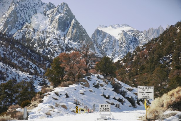
I’m heading west on Whitney Portal Road. Whitney’s in the top left. Apparently, the snow line is usually higher on the mountain. But the West’s been pummeled with snow this year. Thank God.
A closer view. I wouldn’t get much closer. The road up to the tree line is closed for winter.
Here I’m facing north from Whitney Portal Road. Below me is the Owens Valley. Those snowy mountains in the far horizon are the White Mountains. They run north-south, like the Sierras. However, they are a separate mountain chain. The Sierras run on the west side of US 395. The White Mountains run on the east side of US 395. The tallest peak is White Mountain Peak. It reaches 14,252′, and is the 3rd highest peak in California.
The road was closed at the snow line. Here you could only go on foot. No thanks. I don’t like trudging through snow. Not at all.
Here I’m facing east on Whitney Portal Road. Those snowy mountains are another mountain chain called the Inyo Mountains. Like the Sierras, these Inyo Mountains, and the Panamint Mountains to the east of the Inyos, block Pacific moisture from traveling eastward, and help to make Death Valley the hottest and driest place in North America.
This photo’s not that great, obviously. But, I took it because that white, flat area, in the far ground, is the dry lake bed of Owen’s Lake. According to Wikipedia, before Los Angeles bought the Owens River water rights, “Owens Lake was up to 12 miles long and 8 miles wide, covering an area of up to 108 square miles. In the last few hundred years the lake had an average depth of 23 to 50 feet.” When the winds blow hard, alkalized dust hangs heavy in the air, creating an unpleasant and unhealthy ambience.
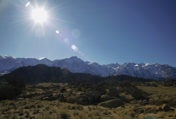
I then drove down Movie Road through the Alabama Hills. Like I said, drab-orange, igneous boulders clumped together to form hills. It’s not amaaazing. But, I can see why many movies were filmed here.
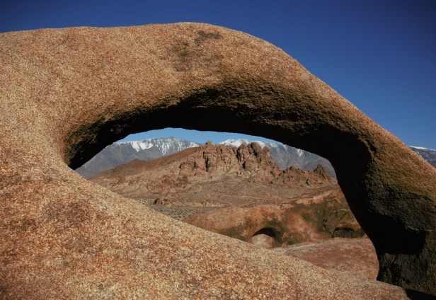
Took at hike to see the Mobius Arch.
The Mobius Arch
Cold air blew hard from that “Sierra Nevada” – that “snow-covered mountain range” in Spanish. Sierra is also the Spanish word for “saw”. Makes sense.
Ultimately, I’m glad I drove west to Lone Pine. Had to get curiosity out of my system. If I don’t come back for a while, well, I’ll be fine.