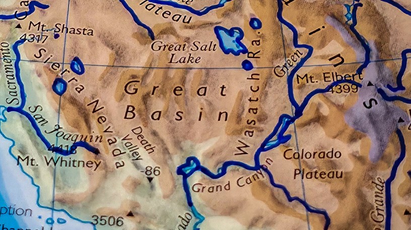
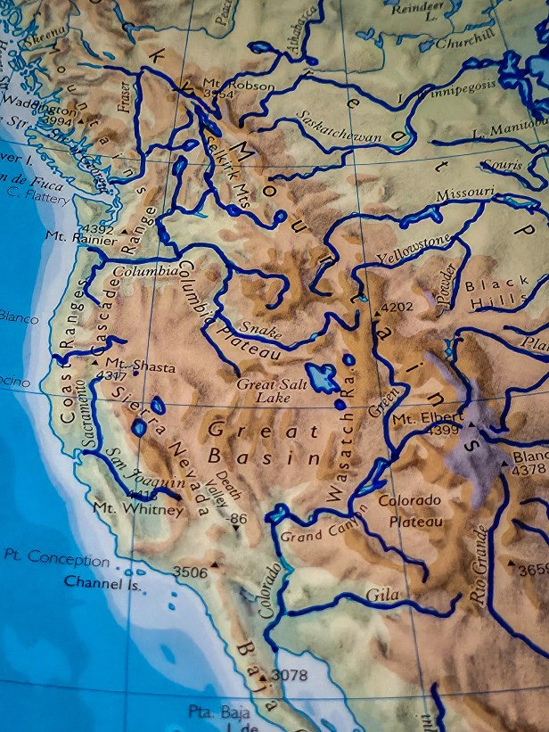
I like this map. It’s from an Oxford world atlas. It’s a photo of a page.
Look how big the Great Basin is. You know what it is?
It’s an area of land, within the United States, west of the Continental Divide, where the rivers do not flow to the ocean, if there are rivers at all.
Wherever and whenever streams flow within the Great Basin (a huge desert whose epicenter is in Nevada) they don’t flow to the ocean, like most rivers. They flow to a depression in the land, and water of that river can accumulate to create a temporary or ephemeral lake.
The river basin and the ephemeral lake comprise what is called an endorhenic basin. Essentially, an endorheic basin is a river that doesn’t flow to the ocean.
The Great Basin is comprised of perhaps 100 endorheic basins, from Eastern California, across Nevada, into Western Utah, and north a bit into Idaho and Oregon. Most of those endorheic basins are dry most of the year. They only have water after heavy rains or snows.
Again, the Great Basin is a huge (and lonely) desert.
However, once upon a time, certainly after the Flood, and also likely 1,000 years ago when rains fell much more in the Southwest, there could have been hundreds of lakes across the Great Basin. I’d bet many were permanent.
Now, however, there are only a few permanent lakes. The Great Salt Lake is one. So is Utah Lake. Ever heard of Lake Tahoe? That’s an endorheic basin on the far western edge of the Great Basin, which ends at the crest of California’s Sierra Nevadas.
West of that Sierra crest several tributary rivers flow west into the Sacramento River and then into San Francisco Bay (an inlet of the Pacific). North of the Great Basin is the Columbia Basin which flows to the Pacific at Astoria. East is the Colorado Basin, which no longer flows to the Pacific Ocean for… reasons.
But you can read a map, right? I like this one.

