First, what is the Great Basin?
It’s mountains rising 7000′ to 13000′. Atop those mountains it’s cool. Rain falls. Snow falls. Pines, fir and spruce grow to form sky islands. Deer, elk and bear roam. So do countless other animals. Indeed there’s rich life in the Great Basin.
But it’s also desolation. Between those mountains live brush and sand, if that. Animals living on the mountains generally don’t roam around. They’re virtually stuck on their island. After all, how are they going to drink water if it evaporates before hitting the ground of those desert valleys? Between the mountains it can be hot.
“The Great Basin” is a physiographic region of the American West. What’s a physiographic region? It’s an area with relatively homogeneous physical geography. (1) Physiographic regions share common topographic, geologic and climactic features, which naturally create similar flora and fauna. The Appalachian Mountains, the Great Planes, the Rocky Mountains, the Colorado Plateau and, yes, the Great Basin are all physiographic regions. Got it?
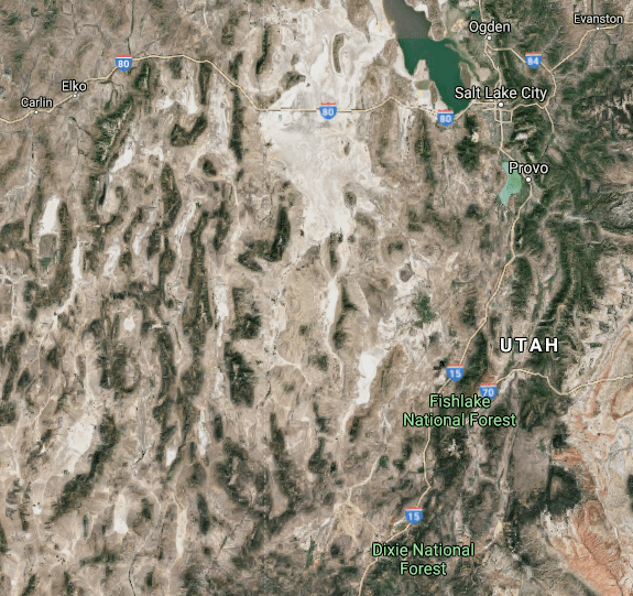
What essential features define the Great Basin? Like I said: deserts separated by mountains. Look at the Google Maps snippet above. It’s of western Utah and eastern Nevada. See the dark areas? Those are the mountains covered by trees. Orographic lift causes those trees. See the brown areas? Those are deserts between the mountains. This alternation between desert and mountain characterizes the vast majority of the area. Summers are hot. Winters are cold. But, generally, except for the mountain tops, the area is dry.
But why “basin” in “Great Basin”? Simple. A basin is a tract of land that receives water and drains it all to the same river or its tributaries. For example, you have the Mississippi River Basin, which is the huge area of the United States drained by the Mississippi and all its tributaries, like the Red, Arkansas, Missouri and Ohio, and those tributaries’ tributaries like the Canadian, Platte, Yellowstone, Tennessee, etc.
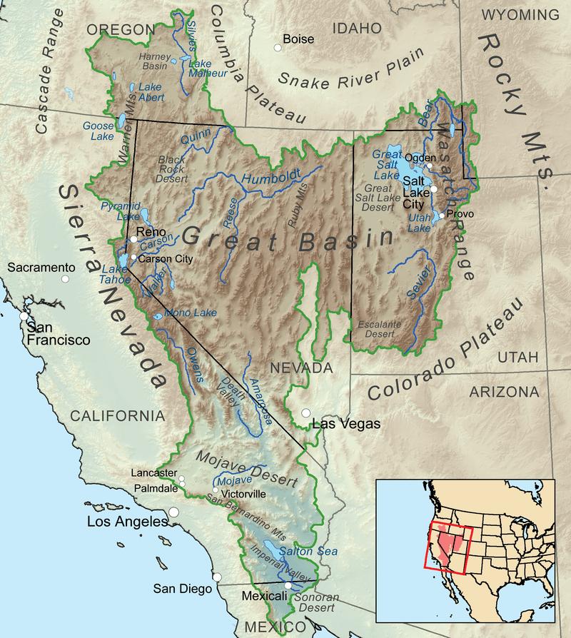
Above image taken from Wikipedia’s page for “Great Basin” (2)
But the Great Basin is unique. This area is 209,162 square miles (2) of land that does not drain water into the ocean, like all other river basins of America. Nope. The rain falls into a bowl, and stays there. Now, the Great Basin is not one gigantic bowl whose center is in the middle of Nowhere, Nevada. Rather there are many independent drainage basins constituting the greater great basin. There are many bowls within the Great Basin.
Each bowl is different. Some are bigger and wetter than others. Some bowls host year-round running rivers, like the Humboldt of northern Nevada, which flows to its lowest point to form a marshy lake that varies greatly in size from season to season. Other bowls have ephemeral rivers and lakes that dry up entirely, like the Amargosa that flows into the Badwater Basin of Death Valley. One big bowl is the Great Salt Lake. Regardless, nowhere within the Great Basin does water flow to the Pacific Ocean.
The majority of the Great Basin is in Nevada, which, overall, is very dry. The dry landscape is primarily caused by the fact that it is in the rain shadows of the Rockies, Cascades and Sierra Nevadas. Those mountains block moisture. Most moisture that would drift into the Basin falls on those mountains along the perimter. The population density over most of the state is low. 3,080,156 people were estimated to live here in 2019 – 281,883 in rural Nevada (3). Across most of the state independent wells tapping ancient aquifers allow people to live in small towns.
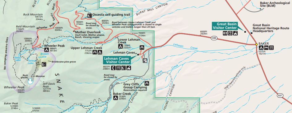
A snippet of the Great Basin National Park’s official map
And Baker, Nevada is a small town. This is where I stayed on Monday the 31st of May in the year of our Lord 2021 because it was five miles from the Great Basin National Park. This Park is small. It receives roughly 90,000 people a year (4). But, it has Wheeler Peak. This is the tallest mountain in Nevada, which reaches 13,064′. I’d never been to this Park. I figured it would perfectly embody the great changes of land and weather to be felt as one travels from the desert below to the mountain top (at least close to the top).
The main park road takes you up to 10,000′. The views alone would be worth the drive. I figured I’d drive up and see what happens. Though, I was not interested in hiking over 3000′ up to the top of Wheeler along a path still packed with snow. The hike at the end of the road seemed more inviting.
And it was.
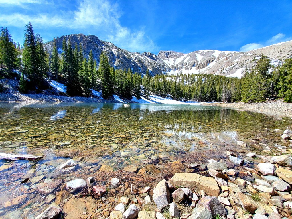
The trails took me to an alpine lake formed by snowmelt. The taste of cold, mountain water refreshed. Undoubtedly this is a watering hole for the many animals living on Wheeler. Not just a few hot hikers jump in the water when it is hot on the mountain.
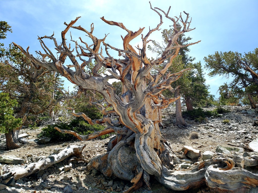
Then, the bristlecone pines. These are thousands of years old. A plaque in front of one tree said it was 3,200 years old. This tree was born in the times of the Book of Samuel. Some in that grove may be older. Some, now dead but still standing due to their strong wood, were born before Abraham walked the earth, literally. (Though, the oldest ones are at the Ancient Bristlecone Pine Forest of Inyo County, California. And their birth fascinatingly corresponds to a time that some argue was right after the waters of the Noahic Flood drained…)
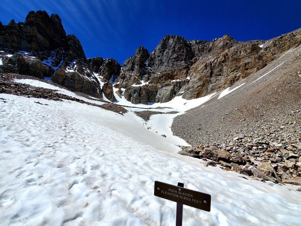
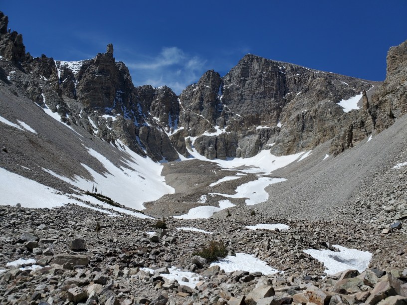
Then, lo, the glacier. This blew me away. At least, that’s what the Park called it. A glacier is, essentially, a perpetual snowmass. That is, the area receives more snow than it can melt throughout the year. I didn’t expect this in Nevada. Yet, there it is. But, it’s there because the shadows of Wheeler Peak prevent some part of the snowmass below it from receiving sun virtually all year-round, and thus the snow remains. Hiking up to here to 10,800′ was sweet.
From a desert to a glacier the day took me. What a trail! What views! The experience felt great. The five miles I walked above 10,000′ was easy. Not being a fatty helps.
Then, it was time to head back. The end of the day found me at Ely, Nevada, in a motel. What a day. A glacier in the Great Basin…. I had no idea.
And, there is more of this giant Basin to be seen. I’d like to see that Humboldt River. Death Valley National Park is huge. So on and so forth.
But there it is. I realize many people have no interest or desire to interpret landforms. That’s ok. There are some who do.
(1) Physiographic Regions | The Canadian Encyclopedia
(3) Rural health for Nevada Introduction – Rural Health Information Hub
(4) Is Great Basin National Park Worth Visiting? – Van Life Wanderer

Very nice post and the photo of the alpine lake looks stunning!
Also, I know very well what you mean by the taste of cold, mountain water.
Also, very interesting to see the Rock Glacier.
Thanks for sharing and greets from Greece.
LikeLike
Geez. I totally forgot to respond. Thanks for paying attention, καλό μου κύριε.
LikeLike