
***NOTE*** The photos I share herein are from my Samsung, not Nikon. I shoot in raw in my Nikon, and I can’t download “TIF” (raw) files to wordpress. Just JPG. Thus, to share my often, but not always, better Nikon photos, I have to change them in Light Room, which is a process that can take hours. On the road this is hard for me. Thus, the photos I share in blogs like these aren’t my best.
*
On Tuesday June 28th my destination was the North Rim of Grand Canyon. I didn’t know how long I’d be there.
First things first. What in the world is meant by “North Rim”? Well, look at the Google Map snippet below.
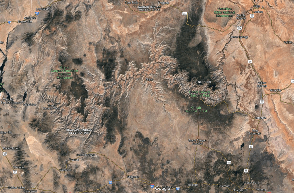
That’s the Grand Canyon. You can see it, more or less, runs from the east to the west. Yes it meanders up and down. Yes there is an “East Rim” on the Navajo lands and a “West Rim” on the Hualapai lands. Nonetheless, because it runs east to west, the canyon is naturally dived into the south side, or South Rim, and north side, or North Rim. Got it?
90% of tourists go to the South Rim. That’s because it’s more easily accessible. It’s closer to Flagstaff and I-40. The North Rim ain’t close to nothing. In fact, I have read the most sparsely populated area of the Lower 48 is the Arizona Strip, which is that part of Arizona north of Grand Canyon, south of Utah, and east of Nevada. The North Rim portion of Grand Canyon national park is in the Strip.
Some say the North Rim blows the South Rim away. At some overlooks, I’d agree.
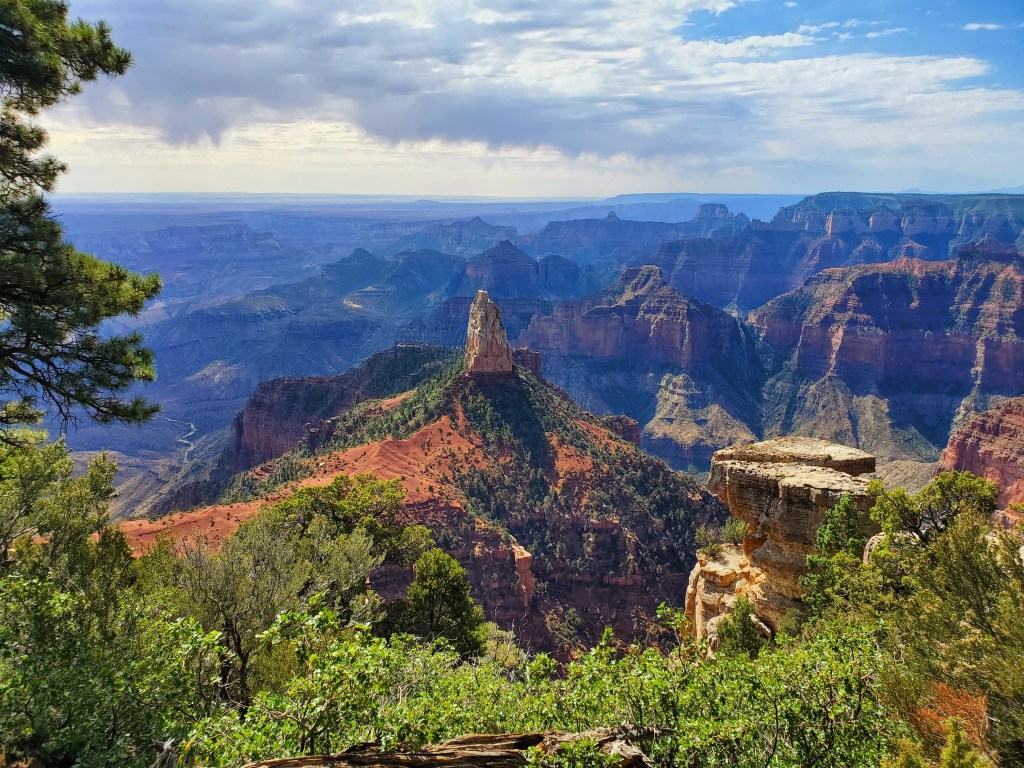
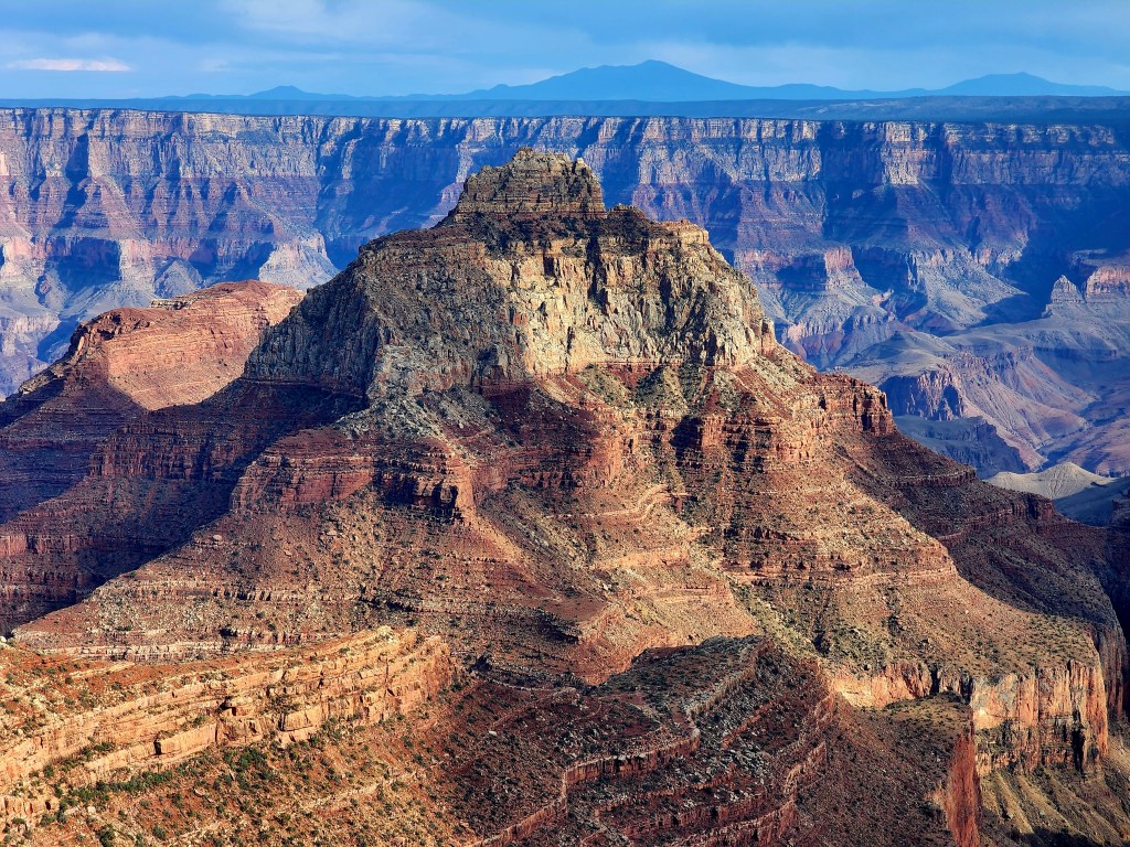
See, the North Rim is higher than the South Rim. The Kaibab Plateau that the Colorado River cuts into to create the national park portion of Grand Canyon inclines downward from north to south. (You can see the Kaibab in the snippet above as the dark green swath of land on the right half of the snippet). The North Rim averages 8,000′. The South Rim averages 7,000′. Thus, because you are higher on the North Rim, you can have more spectacular views, and Point Imperial, which is at 8,800′, is certainly one of them.
At the same time, the horizontal distance from the North Rim to the Colorado River is generally longer than that distance on the South Rim. This is to say the South Rim has more a more sheer vertical drop to the river, whereas the North Rim’s drop is more elongated. Sheer vertical drop from the Rim is where the Canyon’s awe is enhanced. Thus, because the South Rim has more sheer drop, I say the South is every bit as good as the North, though. I’ve been to the South hundreds of times, and am always awed by it.
But I’d only spent about five total days on the North Rim. Not only is it quite out of the way – 4.5 hours from Sedona – it’s closed from October 15th to May 15th because the snowfall is higher at the North Rim’s higher elevations. There would be many dead tourists on the North Rim for getting caught in blizzards with no help capable of reaching them. So the park just shuts down for seven months.
And when the North Rim is open, well, the weather tends to be heavenly. Arizona begins to heat up ferociously in May and June, but at 8000′ on the North Rim, life is dandy. It can still get downright cold at night, and campfires are a wanted thing. It can still snow on the North Rim into June.
Regardless, when I left on that Tuesday the 28th, I was expecting only perfect weather. I didn’t know how many days I’d stay, nor did I know where I’d stay. The campground in the park is fully reserved for weeks in advance. The DeMotte campground in the national forest outside the park was likely fully booked. My only option would be dispersed camping. So be it.
I headed to Point Imperial first. Got there at like 3 pm. Stayed there for almost 5 hours. Got 200 photos of the sunset out there. Many people say “photos just don’t do the Canyon justice” and it’s true THEIR photos don’t, but, often, mine don’t either. The enormity of the view from this highest point on all 277 miles of Grand Canyon’s meandering distance is why it’s awesome. But capturing enormity with a camera can be difficult. Yes, the colors and contours of the buttes, mesas and side canyons are worthy of capture, but, other spots along the rim may be better for that. Imperial’s enormity is what makes it. I share a photo below.
PHOTOS

Five hours, in which I also read and wrote a little, was enough. Thereafter, I headed to a dispersed site, set up my cot tent, and fell asleep by 10.
*
On the morning of Wednesday the 29th, as I was breaking camp, and wishing I didn’t have to, I realized I forgot my hiking boots in Sedona. I spend most of my traveling days in sandals, but, at some point, I’d need those size 15 Lowa boots, because even in big cities I can’t find durable boots for me. So, I decided I head back to Sedona on Thursday morning, and turn right back around.
Now, I don’t want to go into too much detail of this day. That would be boring.
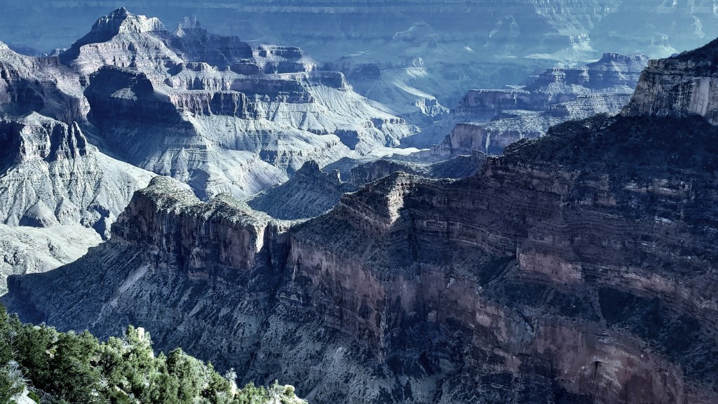
I went to where the North Rim Lodge is, and saw the views out there. The morning light wasn’t conducive to the photos I wanted, unlike some good photos I got in August of 2020 which are below.

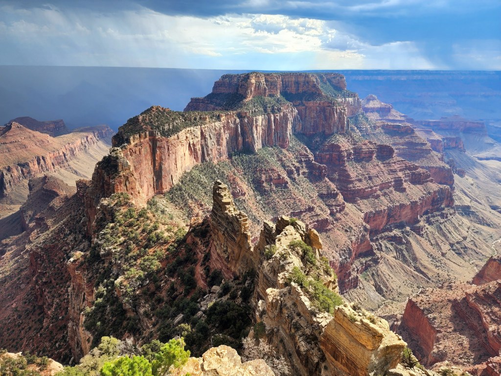
I could see clouds rising in the east, so I decided I’d wait out the afternoon at the southern end of Cape Royal, which is a “peninsula” of the Rim jutting out quit far into the canyon.
That’s what I did. Got the below photos. When the rain poured I ran to my car to wait it out. When it ceased I went right back to shooting. Took hundreds here too.

Anyway, after the shooting, went back to the dispersed site, and set up my tent cot, and drove back to Sedona in the morning to get my hiking boots, thinking I’d come right back here Thursday afternoon.
