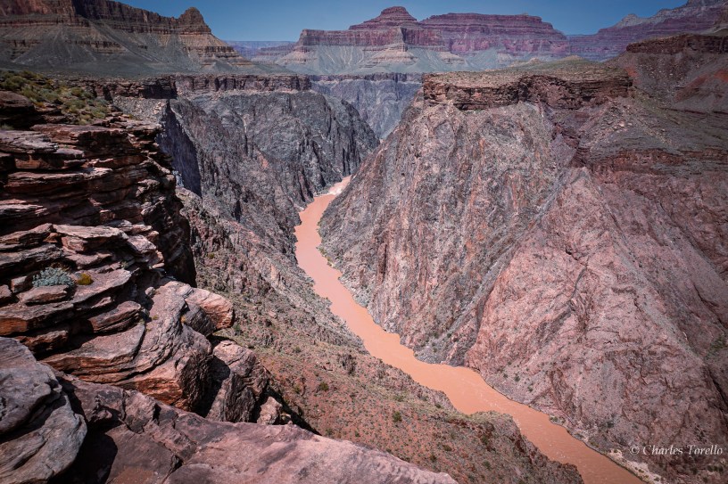
Again, I realize that sometimes it’s necessary for me to explain basic concepts of geography. I myself didn’t know any of this stuff until my 30’s and 40’s, and I’m presuming others don’t have every technical word down either. That’s totally fine. I probably shouldn’t presume I myself have every word I use down either.
Regardless, I can use the word “Colorado” a lot in my tours and writings. That’s because there are significant geographical features out West in addition to the State that also bear the name Colorado, and I’d just like to clarify the Four.
Before we begin, know that “Colorado” in Spanish means “Red Colored”. Colorado doesn’t mean colored. It specifically means red-colored, and the prevalence of this word from Texas to California and northward attests to the red sediments of the land and the rivers which drain those red sediments to the ocean, especially after rains and snows.
The prevalence of Colorado’s also attests to the presence of the Spanish-speakers in the Southwest who named many places with Spanish words that we still use today, like California, Colorado, Nuevo Mexico, Arizonac, Tejas, etc. (But the Spanish footprint in the Southwest is for another time.)
Let us begin.
#1, you have the Texas Colorado River. It’s a river that flows across Texas. Its furthest upstream basin reaches into New Mexico west of Lubbock. The channel from there runs southeasterly and collects red sediments and groundwater from tributary creeks and tributary rivers like the Concho, San Saba, Llano and Pedernales. In the Hill Country it’s damned up to create the Highland Lakes, where the sediments fall to the bottom and make the water clear for retirees. In southeast Austin is located the last dam on the Texas Colorado before it merrily continues into Matagorda Bay on the Gulf of Mexico. It’s a beautiful river, and deserves more words than this.
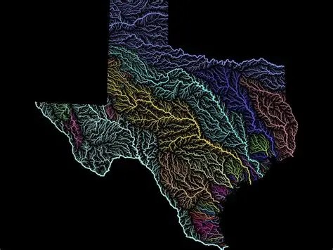
Below is a map of the river basins of Texas I stole. I wish I could make my own maps. But I can’t. So I use what I find. On this map, the Texas Colorado River Basin is the yellow one right in the middle.
#2, you have the State of Colorado. It’s called the Centennial State because it became State #38 in 1876, or 100 years after the signing of the Declaration of Independence. It’s a beautiful state. It’s a gem of a state (though it is run by commies). This State deserves many words too. However, the most pertinent things about the State of Colorado are the other two Colorado’s I’m referring to in this blog. Those two others are the #3 Colorado River of the West, which begins in Colorado, and the western geographic portion of the the State of Colorado called the #4 Colorado Plateau.
Hereafter when I say “Colorado River” I’m referring to the Colorado of the West and not the Texas Colorado. Where does the Colorado River begin? Well, northwest of Denver, there’s a National Park called Rocky Mountain, through which the Continental Divide runs. West of the Divide in that Park is born the main channel of the Colorado River from the snowmelt of the mountains above. It flows westward across the State, and receives more water from tributaries that are also born from Colorado’s Rocky Mountains.
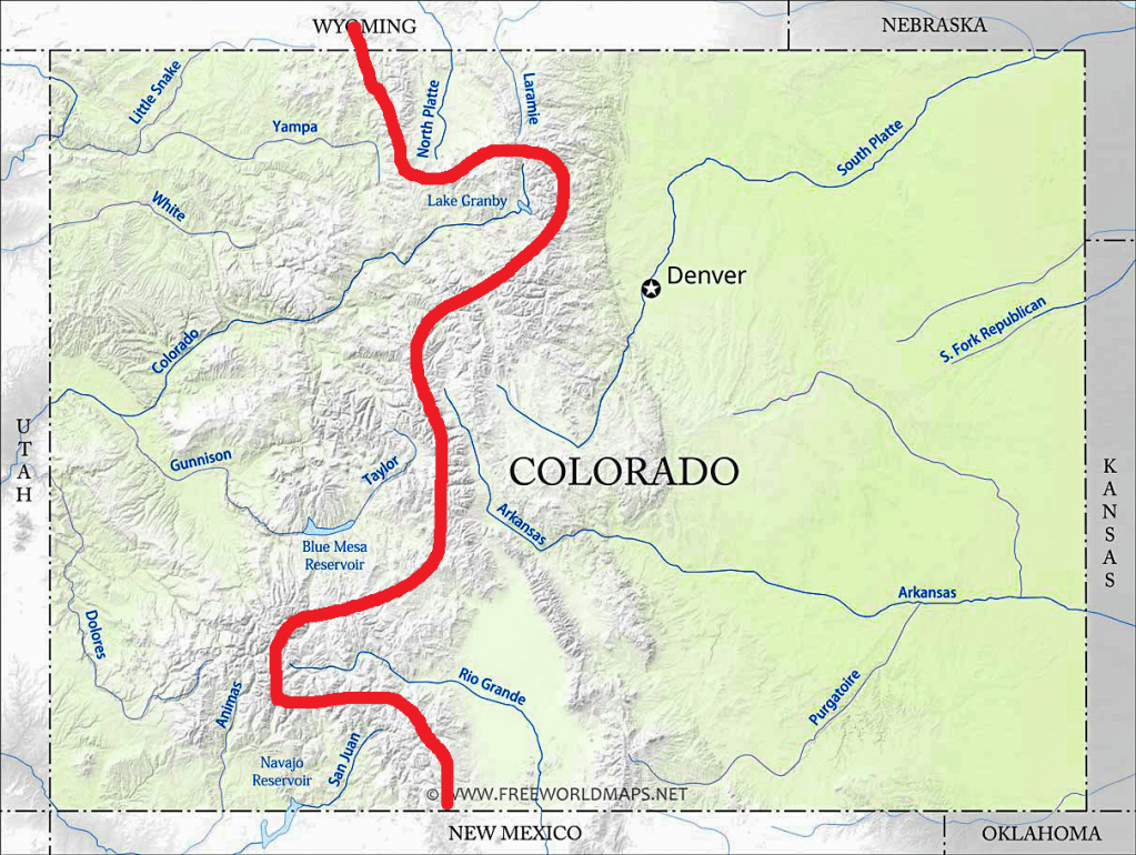
Below is a map of the River Basins (2) of Colorado I stole and embellished by drawing in the Continental Divide. The blue line above Lake Granby is the Colorado River beginning. All rivers west of the Divide are Colorado tributaries. Rivers that flow into Utah – Yampa, White, Dolores, San Juan – confluence with the Colorado there.
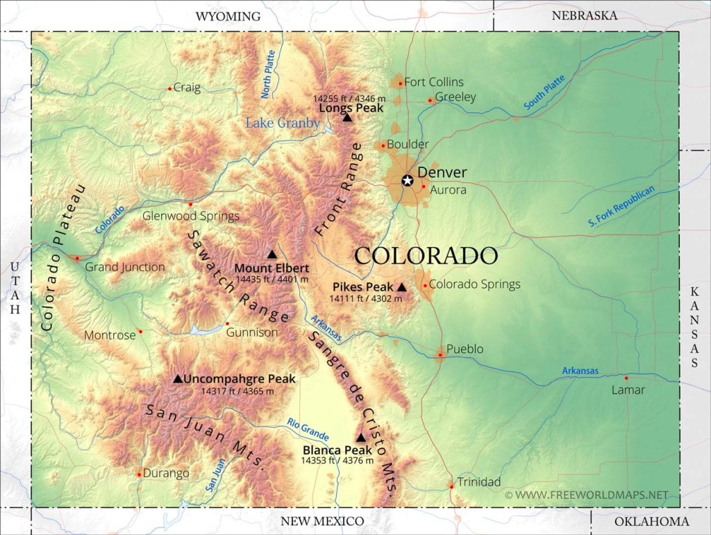
Now, west of the lovely and overpriced town of Glennwood Springs, Colorado (and thus still within the State) the Colorado River leaves the granite of the Rocky Mountains and enters the sandstone country of our fourth Colorado which is the Colorado Plateau.
Below is a fairly clear map of the 3 main geographic (actually “physiographic”) regions of the State of Colorado. In the east you have the Great Plains. In the middle you have the Rocky Mountains. In the west you have you the Colorado Plateau, which is labeled. You can also see where Glennwood Springs is.
#4, the Colorado Plateau is a major geographic province that stretches across a large swathe of the American Southwest, beyond the State of Colorado. The Plateau is characterized by high plateaus and deep canyons of red and other colored shales, sandstones, limestones and mudstones – sedimentary rocks – that stack and swirl together to create a wondrous landscape.
Personally, I think the Colorado Plateau testifies to God’s artistry while carving the Colorado River Basin through the Noahic Flood’s tectonic dump of sedimentary layers upon primordial rocks (aka pre-Cambrian rocks) that now comprise the Plateau, and I couldn’t be more serious.
Of course, I recognize that modern cademia regards such an interpretation as deranged. Academia has long rejected interpreting the geography of Earth through the Genesis Flood. Academia slowly replaced Genesis with a Big Bang, Evolution and an Earth millions to billions of years old which allowed the same forces of nature operating today enough time to create the Earth’s great geological works, like granite mountains and huge dumps of sediments to form high plateaus.
I don’t believe the academics for a multitude of reasons, none of them being that I believe I’ll go to hell if I believe otherwise. However, my full opinions on this matter would be a further distraction to the ultimate point of making you aware that this thing called the Colorado Plateau – our Fourth Colorado- exists.
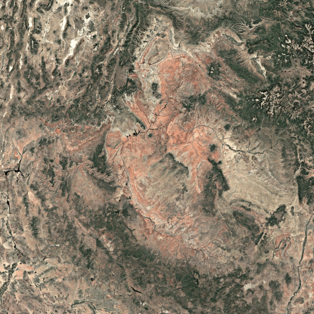
In ending, the Plateau contains some of the most beautiful landscapes on Earth, which is why the highest concentration of federal and state recreation lands stretch across this area. At times it’s ethereal. I show below a snippet from Google Earth which shows the red-hued nature of the Red-Colored or Colorado Plateau. I could have filled the map with place-names, but just look at the Plateau. You can see the Colorado River in the middle. On the left edge of this snippet you can see Lake Mead. Las Vegas is just off the map.
So, there are the Four Colorado’s. I hope you learned something. I hope you enjoyed learning it.
SOURCES OF STOLEN MAPS:
(1) tse1.mm.bing.net/th/id/OIP.Gp5UBdHvCfmGvDj7Te1DOQHaFj?r=0&rs=1&pid=ImgDetMain&o=7&rm=3
(2) th.bing.com/th/id/R.ea199f9fa694fdedf737d106ab974483?rik=lVJpRHycokzL3A&riu=http%3a%2f%2fwww.freeworldmaps.net%2funited-states%2fcolorado%2fcolorado-rivers-map.jpg&ehk=vDcn2GMl6KAowRg3Gvjp%2fdeQDLULqMc87iiK0km2NZk%3d&risl=&pid=ImgRaw&r=0
(3) go-leasing24.info/online-image-tools.html
(4) Google Earth


