When you travel alone, as I always have, you get lonely. I’m not saying that to evoke pity. It’s just not the ideal way for a man to always be.
This situation I take full responsibility for (although, to be fair to myself, feminism, tattoos, blue hair, pierced noses, and generally thinking I wanna here a woman’s opinion on anything have played parts as well (but I still love the ladies)). My point is that loneliness creates the impulse to move onward. It’s harder to sit still.
Now, I may have gone back to Wotan’s Throne or Point Imperial on the North Rim (where I was on 2026-5-31) and perhaps wait all day if storms were brewing. Storms create ethereal scenery at Grand Canyon. Even when mere cumulus clouds cover the sky, I can spend hours shooting, hoping to get 1 or 2 likable photos out of the 200 to 800 I’ll shoot.
However, on this Monday the 1st of June in the year of our Lord 2026, the skies over Northern Arizona were going to be perfectly blue. Not a cloud in sight. The light would be hard from 11AM to 6PM, and create too many dark shadows in photos. Therefore photography would be uninspiring. It would be like this for the entire week. Plus it would be hot.
This too motivated me to move on.
My next objective was in the State of Colorado. Specifically, I wanted to see more of a river originally named el río de Nuestra Señora de los Dolores, or the river of Our Lady of Sorrows, which is another homage to the Virgin Mary in the Old Spanish Southwest. The Dolores is a tributary of the Colorado, which begins southwest of Telluride. My post The Four Colorado’s touches on my fascination with all things called Colorado, including humble tributaries. However, we shall touch more upon the Dolores’ red canyon later. First I had to leave Arizona.
First, actually, I had to make coffee.
I do love this black goodness (cream and sugar is for gay people, men). In the boonies, I use the devices in the photos below. My methods may be like a hobo’s, but they work. My coffee stuff stores compactly, along with my cast-iron skillet, for all the cooking devices I need. I heat the kettle; pour the hot water into the cone filter which sits on my Death Valley mug; as my mug fills with dripped-out coffee, I pour it into that pot until there’s no more hot water. I get 2 Death Valley fills from my kettle, and I’m good for the day, usually.

Then I packed up my bedding, which I’m horribly embarrassed to show others, and headed east on US 89A. US 89A runs from Jacob Lake down the east side of the Kaibab Plateau unto the hot, flat sage country noted on maps as House Rock Valley (which is hemmed in by the Kaibab Plateau, Vermillion Cliffs and the Colorado River). House Rock Valley is vast and strange, especially if you’re coming down from the Kaibab. You transition from forest to desert quickly, and see forever on the way down. It has strange cliff dwellings – houses of rock – on the southern edge of the Vermilion Cliffs, and I don’t like driving through here when it’s hot.
At the eastern base of the Kaibab Plateau, there’s an unpaved toad that heads north into Utah called House Rock Valley Road – hereafter House Rock Road, or just House Rock. I’d never driven it before. It takes you 30 miles across desert to Utah. I’d only been by here in my Tundra once before, and I figured why not go? So I did. Below is a Google Earth snippet with the red arrow indicating the path of House Rock Valley Road.

It wasn’t glorious. The sun was already scalding. The dust kicked up on that washboarded road would make me often make close my windows, and I always prefer them open. But House Rock did provide views of a vermilion, choral, pink, orange, white and other hued sedimentary rocks swirling together in unique ways. The Plateau landscapes, to me, attest more to Genesis than a Big Bang, and always provides something cool to look.
Below are three photos of the area. If I had someone driving for me, I would have taken many more. But I’m not rich enough to have a chauffeur.


However, House Rock would be cooler in cooler temperatures. All the Plateau country is best be traversed in fall or spring, when its not too hot or too cold. Unfortunately, I’ve always been guiding in times of perfect temperatures because everyone has the same idea. Forgoing fall guiding to explore more of the Colorado Plateau in cooler air is not an impossibility. I’ve thought about that a lot, and all things are in God’s hands.
Regardless, at the end of the hot, dusty drive, flooded by hard-light unconducive to good photography, a hiker flagged me down. He was a hitch-hiker from Japan. In the exact moment of flagging me down, he had just completed the Arizona Trail, which takes you from Mexico to Utah. At first I thought he may have been some Navajo character out of Breaking Bad. But upon hearing his Japanese accent, I didn’t figure he’d be anything but polite.
I took him to Page, which was on my way. We talked about this and that. At times we had to use Google Translate on our phones. Apparenetly he was a video maker of sorts in Japan. He was married, had a kid, and lived outside Tokyo. I asked him what it was like to commute to the most populated city on Earth, and he said there’s a lot of people. Go figure.
As far as my journey was concerned, I told him I’m heading to New York to see my mother, and would take my time seeing America along the way. I didn’t bother explaining that I was most excited about seeing the Ohio River country between Ohio and Kentucky because his English was not conducive to understanding finer points of American history. Plus, Asians, from Asia, tend to know very little about American history in the first place, which is understandable. My Japanese history is slim, but I do know a bit about Shoguns, Portuguese, Dutch and Commodore Perry. If his English were better, we could have had a dandy of a conversation because I know this dude was smart…
And strong. After all, he’d just walked 400 miles up the Arizona Trail. Below is a map of it. I know that after walking 500 miles across Spain I too was strong and fit. But the Arizona Trail is not filled with cafes, hostels, spring fountains and vineyards offering free wine to pilgrims hiking along the most well accoutered trail on the Earth, as is so on the Way of Saint James in Spain. The Arizona Trail is rugged and isolated. You have to REALLY prepare for provisioning yourself along the way, and, frankly, I don’t know what that would entail. So good on him, whatever his name was. That’s an accomplishment.
As we approached Page, I told him of the giant dam – the Glen Canyon Dam – we were about to see. I explained to him that the dam’s purpose was to retain the large volume of water flowing off the Rockies from New Mexico to Wyoming for watering civilization in the Southwest. I think he understood, and was impressed by Glen Canyon Dam, as he should have been. All people should. It’s the 4th highest in the United States. It’s huge.
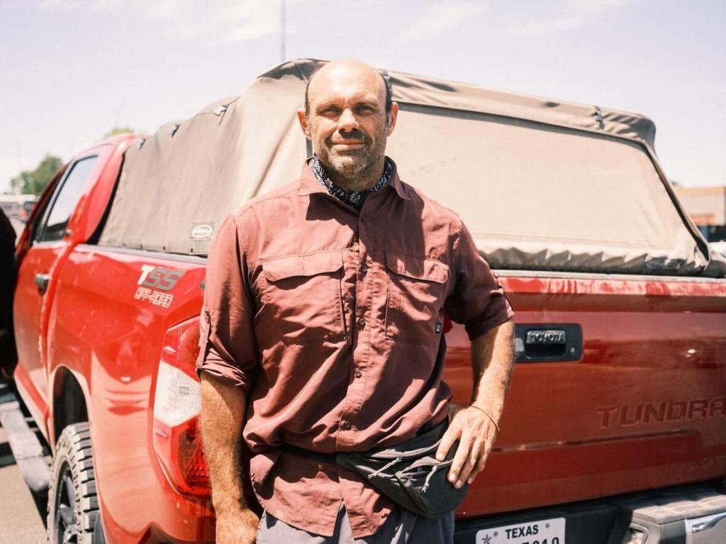
Anyways, in wrapping this post up, I dropped him off at Page’s Safeway. A friend in Phoenix would pick him up the next day. He’d go back to Japan in a couple of days. He took the below photo of me, and I wonder how he’d react if I sent him some photos of my journey. (He would remember me.)
I then continued through the Navajo Rez to metropolises like Kaibito, Kayenta and Teec Nos Pas before passing through a tiny sliver of New Mexico and then into the Ute Mountain Ute Reservation of Southwest Colorado. (The Navajos incorporated the Utah, Arizona and New Mexico corners of the Four Corners into their reservation, but Utes have Colorado’s corner.)
I listened to Daniel Yergin’s “The Prize” along the way. This book details the oil industry from 1859 Pennsylvania to the 1990’s Middle East. It’s can be fascinating. The history of discovering oilfields from Pennsylvania to Baku to Indonesia to Persia to Texas to Latin America was superb. The change to the world’s geopolitical alignments arising from combustion engines fired by gas, diesel and oil was even better. All 36 hours of the book… well… it did drag at times.
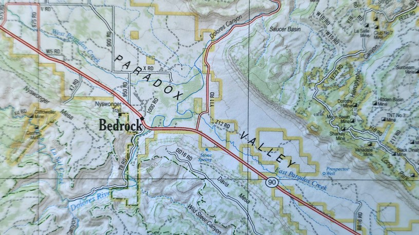
I then continued northward along pave and unpaved roads of Colorado that were filling with me exhaustion. I suppose I could have pulled over at a multitude of places, but didn’t. I finally made it to a spot on page 64 of my DeLorme Colorado atlas. Why there? It was close enough to the part of the Delores River I wanted to explore in the morning.
The spot itself was quiet. Remote. ‘Twas grassy, rolling vales below small and large peaks of Western Colorado’s Rocky Mountains. In the far western horizon were the La Sal mountains of Utah. I intended to drive over them on the morrow as well, and say I took the back way into Moab (where I would not stay because of heat).
I don’t think I heard a car all night, and slept the sleep of the righteous.
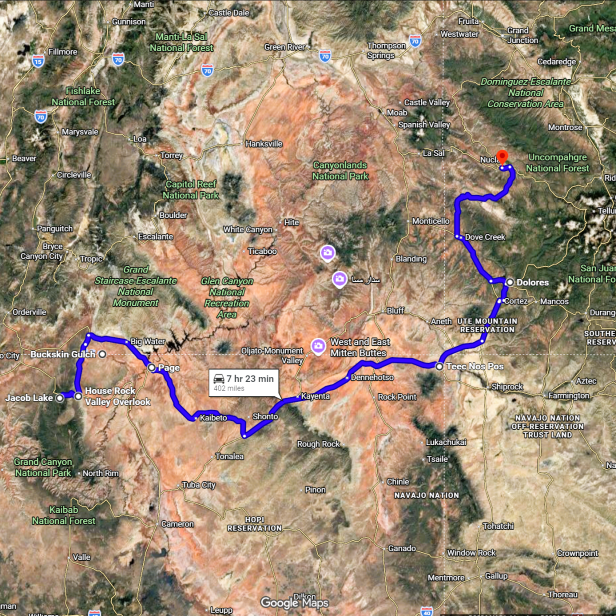
Below is a map of my route for this Monday, June 1st more or less. The red colored land is the Colorado Plateau.