Some can’t follow lines on a map. They can’t follow a blue line. Add lines of other colors and you may as well ask them to perform differential calculus. Ask if the lines are east or west of topo contour lines that mark mountains and their bowels explode. (I have seen this happen.)
Now, I don’t presume that about you, dear reader. I presume you know how to read a map and tie your shoes. It’s just that I don’t presume everyone can. Nor should I.
Just so there is no confusion, allow me to explain quickly how to use a road atlas, like the one I use. I use DeLorme because these Maine-made atlases allow me to see a lot more of the land through which I travel. They show rivers, canyons, mountains, etc, with topographic lines; they show roads going through these land forms, and distinguish paved from the unpaved roads; they show what land is federal; which land is state or private; so on and so forth.
Indeed, road atlases give you a ton of information. I use this to determine what may be a scenic route (obviously roads at the bottom of canyons or atop mountains tend to be more scenic). However, my paths are not always be scenic. Sometimes trees block the views, and sometimes the views are just rocks and sand. Sometimes the entire state is boring.
But you’ll only know if you see for yourself. Some states are definitely more promising of good views, like Colorado. Let’s start there.
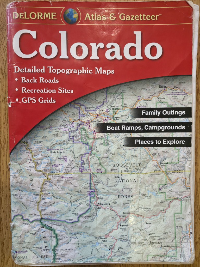
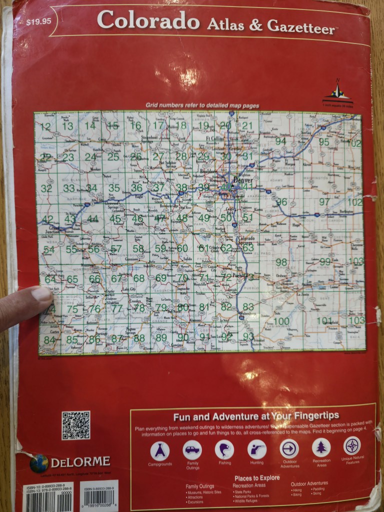
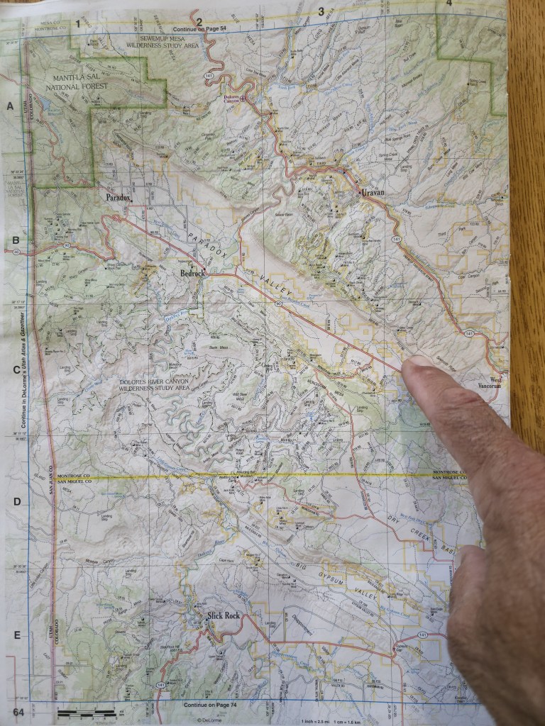
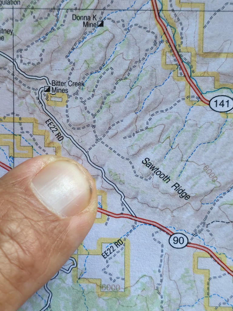
The words of this paragraph refer to the photos of my DeLorme atlas of Colorado below. The front cover shows the state. The back cover shows how the state is divided unto each page of the book. On the morning of Tuesday the 2nd of June in the year of our Lord 2026, I woke up on page 64, the page I’m pointing to. On Monday 2026-6-1 I’d seen that west of Naturita there was BLM land surrounding Colorado Highway 90 (CO 90), and that off road EE22 – whatever that means – would be space to pull over and sleep in the bed of my truck without some armed government agent telling me to be somewhere else. So I did just that, where my finger is also pointing.
(If my finger pointing is still too baffling, no sé qué debería decir.)
Again, I slept the sleep of the righteous. Starry skies. No bugs. No sounds. Just pure stillness in the middle of nowhere.
The first truck along CO 90, about 600 yards away, I heard in the purple, morning twilight. The sound dissipated unto the wide landscape labeled Paradox Valley, but was soon replaced by a succession of other cars and trucks going off to work in I had no idea where. But good on them for finding work in Nowhere, Colorado. I mean that. They see Colorado’s glories a lot.
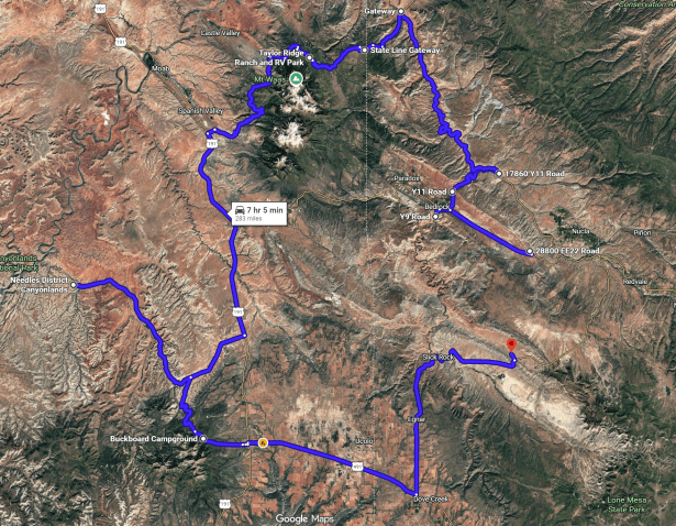
Now, westward on 90 from my campsite was the Dolores River. There were about many miles of road along the river (as indicated below by the arrows) which may yield some photogenic views. I’d follow the blue arrow south and then that red arrow north to CO 141, and take 141 (black arrow), which also parallels the Dolores, to a special place called Gateway (which is off this page).
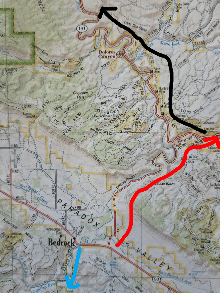
I’d driven 141 to Gateway, Colorado before. That was in May of 2020 (when the corona anus was terrifying libtards), and was surprised to see how much this part of Colorado looks like Utah’s Plateau country. Red buttes like Monument Valley’s rise here and there to give the area its own feel. Somewhere out there on 141 I’d come across a stretch of deep, red canyon above the Dolores which compelled me to stop for photos taken on an old, crappy Samsung. Those photos disappeared, and the idea of re-shooting that red canyon with my Nikon and good Samsung struck me as, well, a good idea.
Then, from Gateway, I’d drive John Brown Road into Utah, as Gateway itself is only 4 crow-miles east of the border. The distance traveled along John Brown would be a bit longer because the road’s cut through a canyon on the east side of the La Sal mountain foot-hills. Once ascending out of John Brown Canyon, and into Utah, John Brown Rd would become State Line Rd and wind around the north face of the La Sal Mountains, whose name is yet another tribute to the Old Spanish Empire in the Southwest.
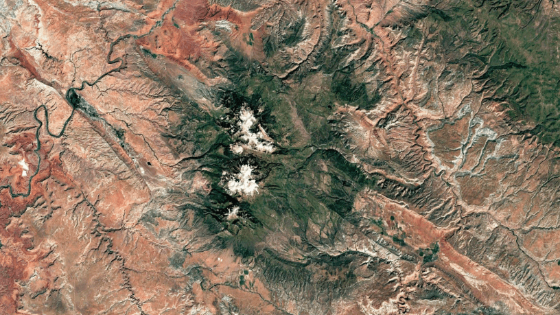
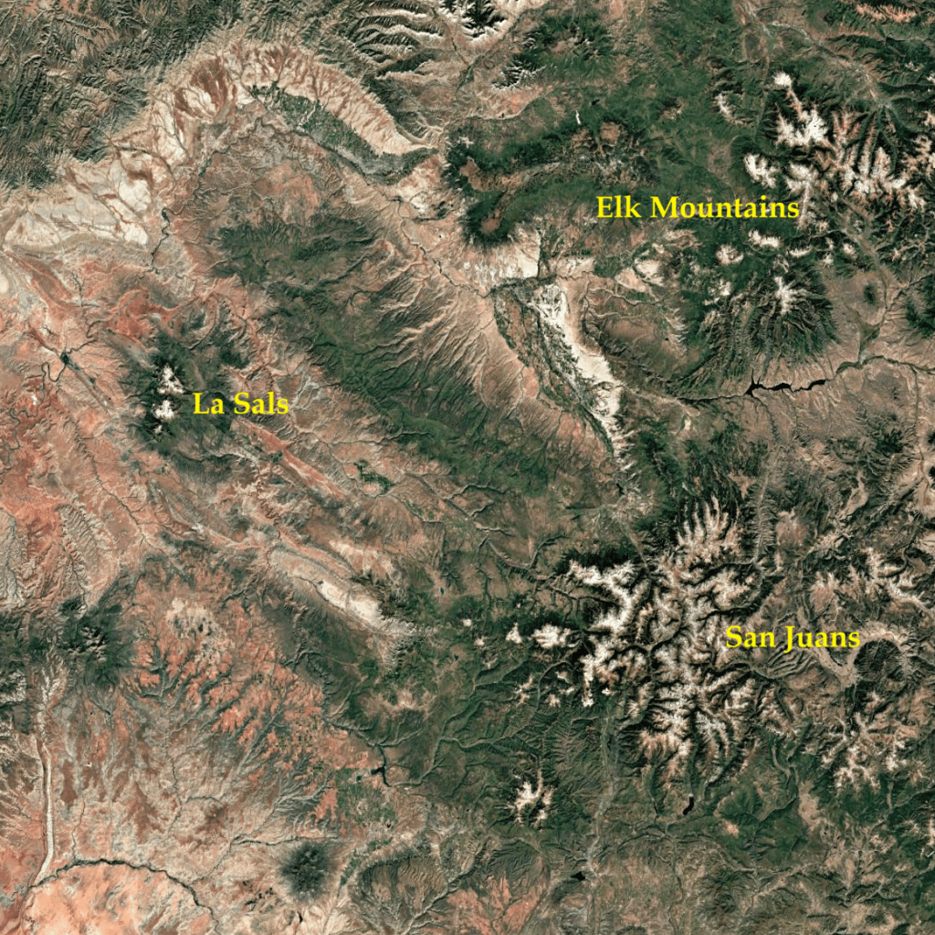
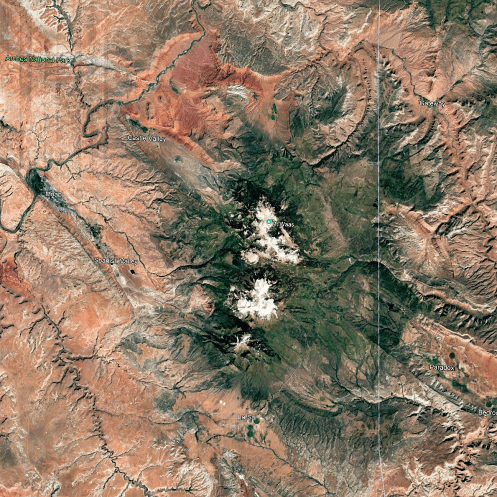
The La Sals rise above Moab to its east. They are considered part of the Rocky Mountains, within Utah. In the Google Earth snippet on the left below you can see that the La Sals are in fact close to the Elk and San Juan Rocky Mountains of Colorado. In the snippet on the right, which is zoomed in on the La Sals, you can see they are surrounded by the red earth of the Colorado Plateau. The La Sals are igneous rocks emanating from the Earth’s crust that pierce through the reddish sedimentary layers of the Plateau.
(I am capable of speaking more to the geology of this area, but don’t want to get bogged down in technical explanations, at least right now. However, do know that sedimentary layers are lithified (hardened) deposits of sediments on top of igneous/metamorphic basement rocks that extend to the Earth’s mantle, and, once again, I do honestly believe evince the Genesis Flood.)
Now, looking at the snippets, perhaps you can surmise that there are wild, colorful views here. There are. West of the La Sals, near Moab, are 2 National Parks: Arches and Cayonlands. I’ve been to both, but when it’s hot. Like I said in my 2026-6-1 post, the Colorado Plateau is best to explore in spring or fall, when it’s not too hot or too cold. All my photos of Arches NP have disappeared, and, by gosh, there are incredible sights there.
However, they would not be seen on this hot and sunny Tuesday. My objective was to see the La Sals, and then see transition from alpine to red desert, and hope photogenic opportunities present themselves. But if not, no big deal. I most wanted to go over the mountains.
And that’s what I did. Made it into Moab. Too damn hot. On the way out I did, however, make a detour into the Needles District of Canyonlands, but didn’t stay long. Got some photos there too. Afterwards, I headed back towards Colorado via Monticello, Utah, and ended my day close to where I began it.
I am going to share photos from this day on other posts. In ending this one, below is a Google Maps snippet of my route for this day.


Charlie,
You are amazing. Did you take notes as you made the trip? How do you remember all these details. It’s all very interesting, though
Take care,
Gary
LikeLiked by 1 person
Gary, with God as my witness, it means a tremendous amount that you read what I write. It means at least one soul is reading my words, and that helps define my audience. Thanks for caring. Truly.
LikeLike